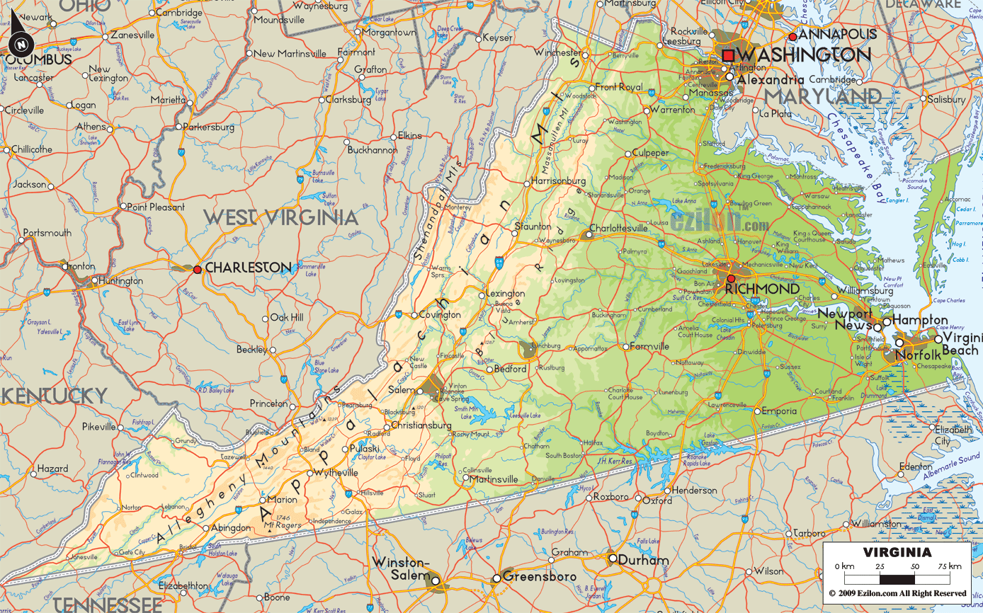

Description: The Physical map of Virginia State, USA showing major geographical features such as rivers, lakes, topography and land formations.
 Introduction:
Virginia is a treasure trove of natural beauty and diverse topography, an intriguing state located on the southeastern shore of the USA. The Large Detailed Physical Map of Virginia reveals a spectacle of geographical elements, stitching together a rich landscape tapestry that invites exploration.
From the soft murmurs of sweeping rivers to the steadfast silence of towering mountains, from the tranquil surface of secluded lakes to the gently rolling hills, every feature is a stanza in the poem of Virginia's natural grandeur. The map is an invitation to journey through the geographical realms of the South, North, East, West, and Central regions, each holding a unique narrative of Earth's bounties.
Southern Virginia unfolds a panorama where the earthly veins of rivers and placid hearts of lakes nestled amidst a terrain of rolling hills and gentle mountains. The Blue Ridge Mountains guard the western frontier, their undulating profiles narrating tales of geological epochs. Among them, Smith Mountain Lake and Philpott Lake are nature's pristine mirrors, reflecting the hues of the sky and the surrounding vegetation.
Roanoke River carves its narrative across the terrain, nurturing fertile plains that stretch across the region. The Dan River further adds to the picturesque beauty, winding through towns and countryside; its banks are a theater of historical and natural narratives. The topography here is a blend of rolling hills, flat river basins, and secluded valleys, each holding an essence of the region's natural charm. As one navigates through the lush terrain, Lake Gaston and Kerr Lake unfold as serene retreats amidst the southern lands, enriching the hydrological narrative.
Northern Virginia is a realm where high hills, river valleys, and expansive forests paint a verdant landscape. The Potomac River asserts its course, its waters swirling around land formations, carving through rocks, and cascading down the Great Falls in a powerful spectacle. The Shenandoah River, a loyal companion to the Potomac, enriches the lands with its fertile touch, painting the valleys a lush green.
The silhouette of Bull Run Mountains stands as ancient sentinels, narrating tales of geological antiquity. Skyline Drive and the Shenandoah National Park along the Blue Ridge Mountains extend an invitation to delve deeper into the region's pristine wilderness. The topography is a picturesque blend of rugged and serene, with mighty rivers carving through the tranquil countryside.
The story evolves upon arrival in Eastern Virginia, as the fertile soil interacts with the coastal breeze, altering its course. The Chesapeake Bay, an estuarine titan, carves a majestic inlet into the land, its waters a confluence for numerous rivers such as the James, York, and Rappahannock. The hills on the eastern side of the area are home to rivers that nourish a diverse ecosystem of plants and animals in the ocean.
The Delmarva Peninsula extends its sandy grasp into the maritime domain, and the Eastern Shore represents a fragile yet beautiful land formation showcasing the harmonious marriage between land and water. The topography exhibits flat, sandy terrains, marshy wetlands, and a network of small, serene rivers and creeks crisscrossing the coastal plains, each holding tales of the region's rich maritime legacy.
As one's eyes wander westward, the topography dramatically transitions into a realm of towering mountains and deep valleys. The Appalachian Mountain Range, a spine of ancient rocks, hosts the Allegheny and Cumberland Mountains, each peak a testament to geological endurance. With its old flow, the New River carves through these rugged lands, narrating tales of when the Earth was young.
The tributaries of the James River, like the Jackson River and Cowpasture River, grace the terrain with their serene flow, weaving around the mountains in a graceful dance. The Greenbrier River further enhances the hydrological narrative, its path a journey through time. The region is a rugged tapestry of high ridges, deep valleys, and rocky outcrops, each contour holding stories of geological vigor and natural resilience.
Central Virginia is where contrasts meet and harmonize under the gentle Virginia sky. The vigorous James River carves a path of life through the Shenandoah Valley and the Piedmont plateau, an undulating landscape of gentle hills, lush forests, and secluded water bodies. Lake Anna and Swift Creek Reservoir are pockets of tranquility amidst this dynamic land, their calm waters offering a serene retreat.
The topography is a gentle transition from the rugged western mountains to the calmer eastern plains, with the Blue Ridge Mountains casting a majestic shadow over the lands. This region is where the heartbeat of Virginia's natural narrative pulsates vividly, every river bend, every hilltop, and every lake a chapter in the endless book of Virginia's geographical grandeur.
The Large Detailed Physical Map of Virginia is not merely a map but a narrative penned by nature, a narrative of how rivers carve, mountains stand, and lands thrive. This in-depth exploration explores the essence of Virginia's diverse geographical and hydrological features, offering a vivid and profound understanding of its natural legacy. It is a journey of discovery through the heart of Virginia, where every contour on the map marks the state's deep-rooted connection with the natural world.

Counties and Road Map of Virginia
Counties and Road map and map image of Virginia.

Regional Directory of Canada
Information and guide about Canada and website listing.

Regional Directory of United States of America
Information and guide about United States of America and websites with American topics.

Regional Directory of Europe
Information and guide about Europe and websites with European topics.

Regional Directory of Australia
Information and guide about Australia and websites with Australian topics.