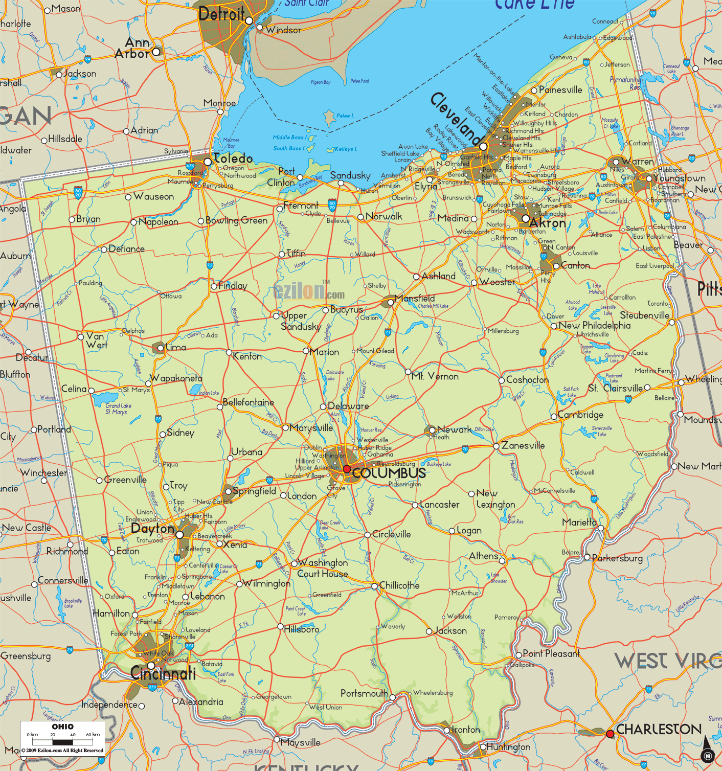

Description: The Physical map of Ohio State, USA showing major geographical features such as rivers, lakes, topography and land formations.
 Introduction:
The Large Detailed Physical Map of Ohio stands as a comprehensive geographical guide, illuminating the expansive natural beauty and topographical diversity of the Buckeye State. As observers delve into the rich contours and numerous details embedded in this map, they embark on a captivating exploration journey through Ohio's vibrant landscapes.
The map meticulously delineates the natural features such as rivers, lakes, mountains, hills, topography, and varied land formations across the southern, northern, eastern, western, and central regions. The map unfolds layers of geographical narratives with each glance, encouraging a deeper understanding and appreciation of Ohio's vast and varied landscapes.
Southern Ohio, known for its rugged terrain molded by the Appalachian Mountains and hills, holds a tale of ancient geological activities showcased brilliantly on the map. The majestic Ohio River is a defining boundary, meandering gracefully along the southern edges. The map meticulously captures its winding course, visualizing the river's extensive riverine network.
Moreover, other smaller yet significant rivers like the Scioto River and Great Miami River, along with quaint lakes, punctuate the landscape, adding a layer of hydrological richness. The map's detailed depiction allows for a vivid imagination of the valleys, highlands, and rolling hills that constitute the heart of Southern Ohio's topography. The map does an excellent job of illustrating the mesmerizing and uneven landscape in this particular part of Ohio.
Lake Erie's calm and expansive waters tenderly cradle the northern frontier of Ohio, creating a contrasting landscape to the southern region. The map accentuates Lake Erie's clear, well-defined shorelines, showcasing numerous small towns and cities snugly nestled along its coast. Besides, the map thoughtfully marks the flow of essential rivers like the Cuyahoga River and Maumee River as they meander towards the lake, offering a glimpse into the hydrological significance of this region.
The topography here is relatively flat, showcasing vast plains interspersed with gentle hills, providing a stark visual contrast to the rugged terrains of the south. The map crafts a narrative of Northern Ohio's geographical diversity through detailed delineations of these elements.
Eastern Ohio is a testament to the lingering essence of the Appalachian foothills, with the map deftly illustrating this region's gentle slopes and ridges. The area also cradles beautiful water bodies like Berlin Lake and West Branch Reservoir, whose calm waters are captured precisely on the map. The diverse land formations are a mix of valleys, ridges, and low-lying areas that contribute to the visual appeal and geographical complexity of Eastern Ohio.
The myriad of small rivers crisscrossing the region, as depicted on the map, contribute to the hydrographic richness of the area. Each river curve and hill contour in Eastern Ohio tells a tale of geological evolution, depicted meticulously on the map.
The western part of Ohio unfolds a narrative of level terrains and gentle undulations peppered with a network of rivers and streams. A notable feature is the Great Miami River, which courses through the region, marking a significant geographical narrative on the map. The land formations predominantly consist of plains and low-lying areas, portraying a serene countryside image.
Here, the Indian Lake emerges as a natural jewel, its peaceful waters contributing to the geographical allure of this region as shown on the map. With its subtle terrain variations, Western Ohio's landscape offers a soothing visual respite, which the map captures in great detail, encouraging the observer to delve deeper into its serene geography.
Central Ohio is between the south's hilly and the north's flat regions. Maps provide a visually appealing representation of the diverse range of land types. Little lakes, rivers, and hills enhance the area's natural beauty, creating a harmonious setting with nature.
The map meticulously outlines geographical features like the Scioto River and Alum Creek Lake, marking the natural landscape of Central Ohio. Columbus, Ohio's capital's urban core, is well represented, emphasizing the symbiotic interaction between urban development and the surrounding natural settings. The map effortlessly bridges the geographical transition from rugged to flat terrains, offering a clear and enriching view of Central Ohio's diversified landscapes.
As a quintessential guide to Ohio's geographical magnificence, the Large Detailed Physical Map of Ohio presents a rich, multi-faceted exploration of the state's terrain. The map meticulously details every river, lake, mountain range, and land formation, unveiling a vivid tableau of Ohio's diverse landscapes.
It becomes an indispensable resource for anyone seeking to explore, understand, and appreciate the physical attributes contributing to Ohio's distinctive geographical identity. Through the detailed lens of this map, observers embark on a visual voyage across Ohio, marveling at the seamless blend of topographies, water bodies, and the varied natural features that define the unique beauty and complexity of the state.

Counties and Road Map of Ohio
Counties and Road map and map image of Ohio.

Regional Directory of Canada
Information and guide about Canada and website listing.

Regional Directory of United States of America
Information and guide about United States of America and websites with American topics.

Regional Directory of Europe
Information and guide about Europe and websites with European topics.

Regional Directory of Australia
Information and guide about Australia and websites with Australian topics.