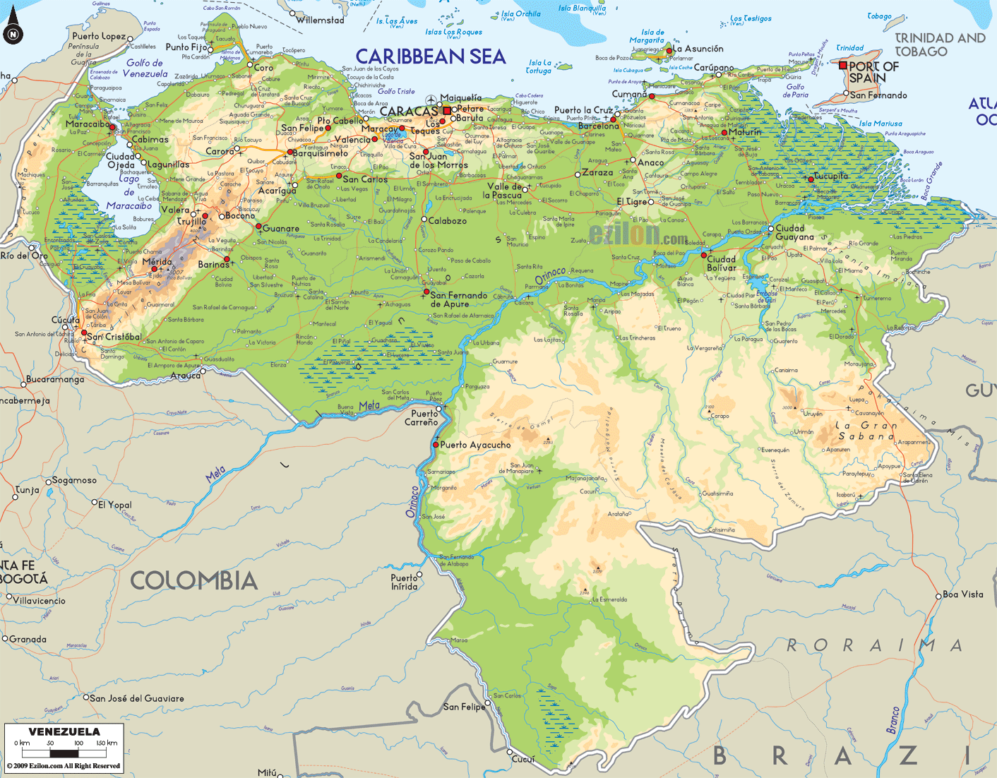

Description: The Physical Map of Venezuela showing major geographical features like elevations, mountain ranges, ocean, lakes, plateaus, peninsulas, rivers, plains, landforms and other topographic features.
 Venezuela
is a country situated on the northern coast of South
America. Its territory covers about 917,000 km2 area on
land. Its habitats range from the Andes Mountains
situated in the west to the Amazon Basin’s rainforests
on its south, which also include the extensive plains of
the llanos and the Caribbean coast in the central region
with the delta of the Orinoco River Delta in the east.
It is roughly shaped like a triangle and has a coastline
of about 2,800 km. It also includes various islands in
the Caribbean. The country has a well-defined topography
consisting of the Maracaibo lowlands in the northwestern
part, the northern mountains which extend like an arc
from east to west, thewide plains covering the central
region as well as the Guiana Highlands in the southeast.
Venezuela is surrounded by Colombia on its west.It has
Guyana in the east as well as Brazil in the south. The
Caribbean islands ofthe Tobago and Trinidad, Grenada,
Aruba, Curaçao and the Leeward Antilles lie along the
coast of Venezuela.
Pico Bolívar is the country's highest point at 5,000 m.
The Guiana Highlands consist of some fringes in the
north of the Amazon Basin. It also has the Angel Falls
which are considered the highest waterfall in the world.

Political Map of Venezuela
Political map and map image of Venezuela.

Regional Directory of South America
Information and guide about South America and website listing.

Regional Directory of United States of America
Information and guide about United States of America and websites with American topics.

Regional Directory of Europe
Information and guide about Europe and websites with European topics.

Regional Directory of Australia
Information and guide about Australia and websites with Australian topics.