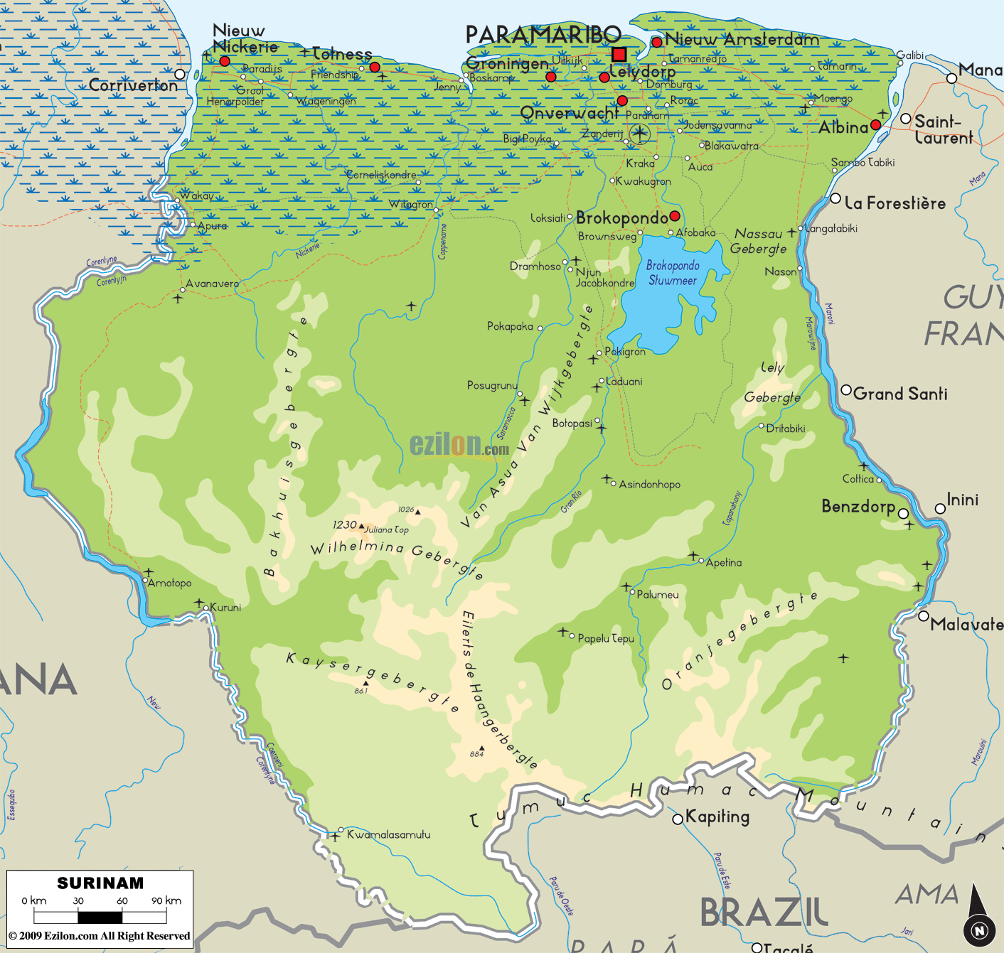

Description: The Physical Map of Surinam showing major geographical features like elevations, mountain ranges, ocean, lakes, plateaus, peninsulas, rivers, plains, landforms and other topographic features.
 Suriname,
officially known as the Republic of, is a country on the
northeastern Atlantic coast of South America. It is
bordered by French Guiana to the east, Guyana to the
west and Brazil to the south. At just under 165,000
square kilometres, Suriname is the smallest sovereign
state of South America.
The country has been divided into two major geographic
regions namely the northern, the lowland coastal area
which lies roughly above the line of
Albina-Wageningen-Paranam, the southern part consists of
tropical rainforest and sparsely inhabited savanna
bordered with Brazil which cover around 80% of
Suriname’s landmass.
Suriname is located between the French Guiana on the
east along with the Guyana on the west. The southern
border has Brazil while the northern border has the
Atlantic coast. The Central Suriname Nature Reserve
which is located in the upperwatershed of the Coppename
River has been designated as the UNESCO World Heritage
Site for its mystic, untouched forests and biodiversity.
It is said that 13% of the nation's landmass consists of
national parks as well as lakes.

Political Map of Surinam
Political map and map image of Surinam.

Regional Directory of South America
Information and guide about South America and website listing.

Regional Directory of United States of America
Information and guide about United States of America and websites with American topics.

Regional Directory of Europe
Information and guide about Europe and websites with European topics.

Regional Directory of Australia
Information and guide about Australia and websites with Australian topics.