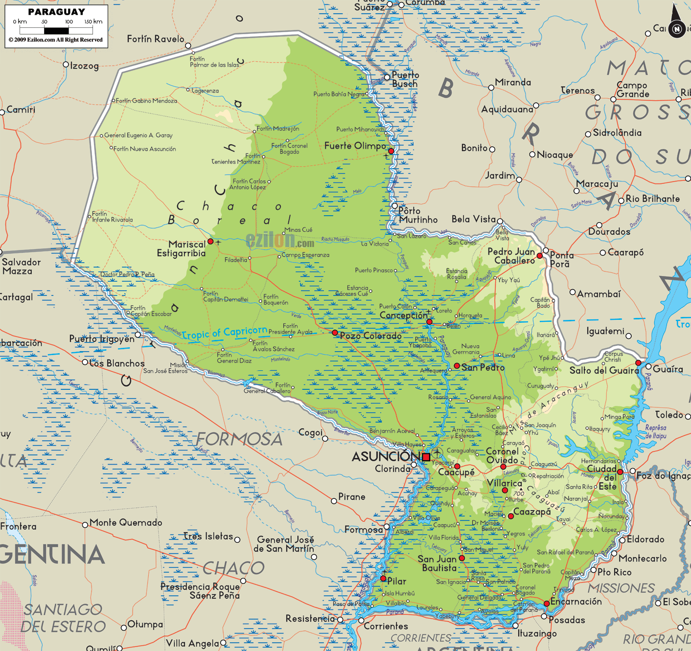

Description: The Physical Map of Paraguay showing major geographical features like elevations, mountain ranges, lakes, plateaus, peninsulas, rivers, plains, landforms and other topographic features.
 Paraguay
is officially called the Republic of Paraguay. It is a
land-locked country situated in central South America
and is bordered by Argentina on the south and southwest.
It has Brazil to its east as well as on the northeast,
with Bolivia on the northwest. Paraguay lies on the two
banks of the River Paraguay that flows through the
central part of the country from the northern tip to the
south.
It is sometimes called the Corazón de América meaning
the "Heart of America", due to its central location in
South America
Paraguay is divided by the Río Paraguay into an eastern
part which is called the Eastern Paraguay or the
Paraguay Oriental, also known as the Paraná region. The
western region is called the Western Paraguay or the
Paraguay Occidental, also known as the Gran Chaco. The
region consists of plains full of grasses and forested
hills on the east. In the west, there exist low, marshy
plains.
The overall climate is tropical as well as subtropical.
Paraguay has only wet as well as dry periods, like other
lands in the continent. The absence of mountainous
rangeswhich may provide a natural wind barrier,has
allowed the winds to pick up speeds as high as 160km/h.

Political Map of Paraguay
Political map and map image of Paraguay.

Regional Directory of South America
Information and guide about South America and website listing.

Regional Directory of United States of America
Information and guide about United States of America and websites with American topics.

Regional Directory of Europe
Information and guide about Europe and websites with European topics.

Regional Directory of Australia
Information and guide about Australia and websites with Australian topics.