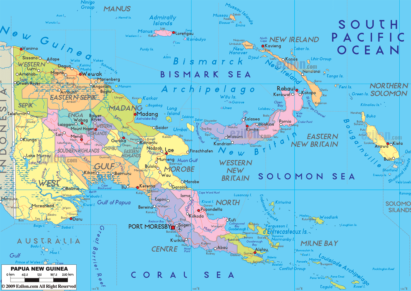

Description: Detailed large political map of Papua New Guinea showing names of capital city, towns, states, provinces and boundaries with neighbouring countries.
 Papua
New Guinea is a nation in Oceania and it lies in the
southwestern Pacific Ocean. Port Moresby is its capital
as well as one of the major cities of this country.
There are several traditional societies in Papua New
Guinea and it has more than eight hundred and fifty
indigenous languages.
This is probably the reason why this country is considered to be one of the most diverse nations in the world. Papua New Guinea has only 18% of its total population living in the cities. The remaining part of its population is still living in the rural areas.
Papua New Guinea is the 54th largest country on earth and the size of the country is slightly bigger than California. This nation is also considered to be one of the least explored countries in the world.
It is believed that there still are many undiscovered species of animals as well as plants that are present in Papua New Guinea’s interior. There are several active volcanoes here and such, eruptions take place frequently.
It is also common for the country to
experience earthquakes. The country is rich in various
natural resources. Agriculture is plays a very important
role in providing livelihood for the people of Papua New
Guinea.

Physical Map of Papua New Guinea
Physical map and map image of Papua New Guinea.

Regional Directory of Australia
Information and guide about Australia and website listing.

Regional Directory of United States of America
Information and guide about United States of America and websites with American topics.

Regional Directory of Europe
Information and guide about Europe and websites with European topics.

Regional Directory of Australia
Information and guide about Australia and websites with Australian topics.