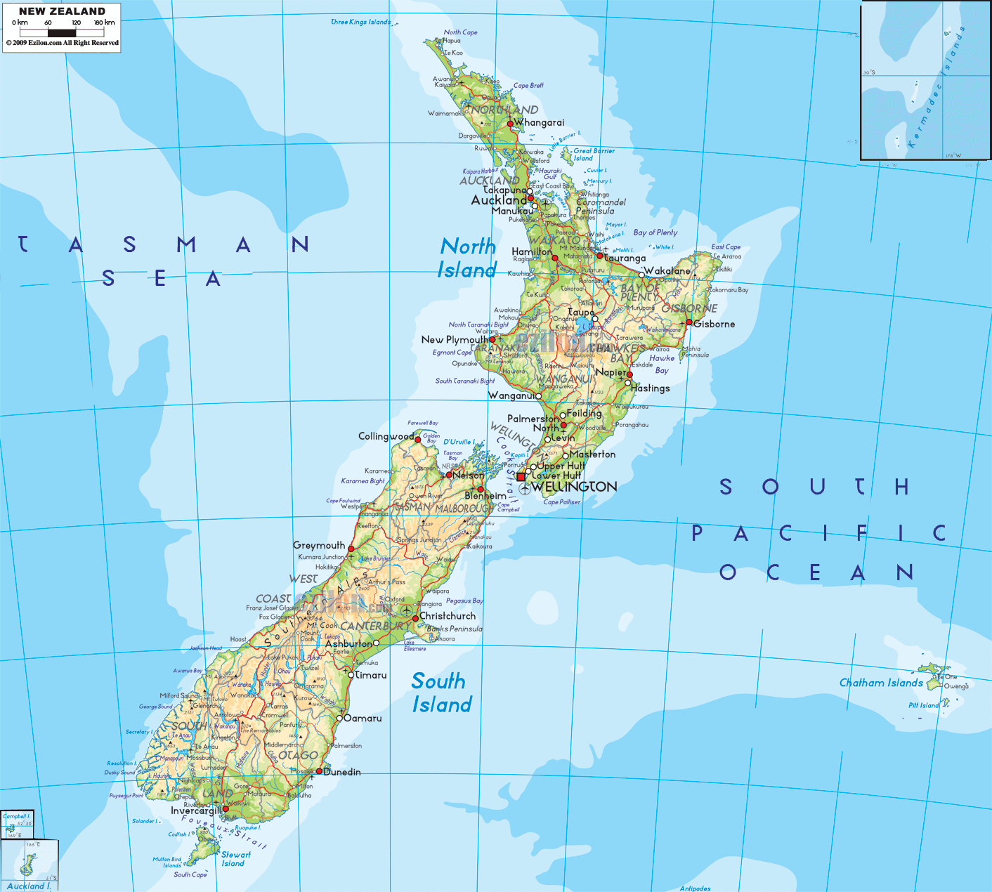

Description: The Physical Map of New Zealand showing major geographical features like elevations, mountain ranges, deserts, lakes, plateaus, peninsulas, rivers, plains, landforms and other topographic features.
 New
Zealand is a country made up of two islands, the North
Island and the South Island and other minute islands
which surround the two main islands. The country lies
between the water hemisphere at 41 degrees south
latitude and 174 degrees east longitude. The area
covered by the country measures in at 267,710 kilometers
square of which 98% is land and 2% is water. The
collective coastlines add up to a staggering 15,134
kilometers in length.
Most of the country’s landscape contains high rugged
peaks. The highest point in the country is known as
Mount Cook and it is 3,754 meters high whereas the
lowest point are the Taieri Plains which lie 2 meters
below sea level. The climates on the islands are diverse
as the people experience hot, cold, wet and sub-tropical
climates.
The groups of islands are the major chunks of the
immersed continent of Zealander which surfaced ages ago.
The south island is cut lengthwise by the Southern Alps
and there are 18 more peaks which stand at over 3,000
meters above sea level. The east side of the island has
plains whereas the west has coastal areas. The north
islands is more volcanic than mountainous. Lake Taupo is
the largest lake in the country and Waikato is the
longest river.

Political Map of New Zealand
Political map and map image of New Zealand.

Regional Directory of Australia
Information and guide about Australia and website listing.

Regional Directory of United States of America
Information and guide about United States of America and websites with American topics.

Regional Directory of Europe
Information and guide about Europe and websites with European topics.

Regional Directory of Australia
Information and guide about Australia and websites with Australian topics.