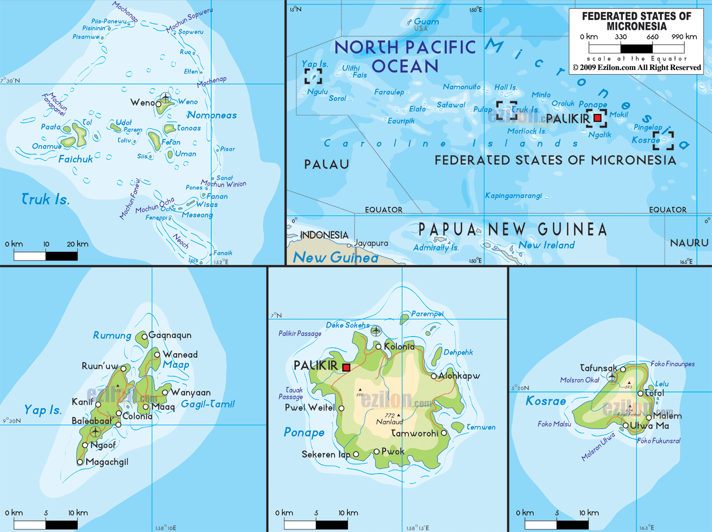

Description: The Physical Map of Micronesia showing major geographical features like elevations, mountain ranges, deserts, lakes, plateaus, peninsulas, rivers, plains, landforms and other topographic features.
 The
Federated States of Micronesia is a country situated in
the Western Pacific Ocean and in the Micronesia region
of Oceania. The group of islands consists of 607
independent islands spread across the ocean. The vast
spread out islands also reaches till the Polynesian
Region. The islands are a part of the Caroline Islands
Archipelago.
The total area covered by the islands measure up to 702
square kilometers of which 100% is land. The total
collective coastline measure in at a massive 6,112
kilometers in length. The terrain is divided into two as
some islands have high rocky peaks while others are low
lying coral atolls. Totolom is a volcanic peak and is
also the highest point in the entire group measuring in
at 791 meters above sea level. The lowest point however
rest at the mean sea level with the Pacific Ocean. The
islands have rainfall all throughout the year and most
of it falls on the east based islands.
The islands with the rugged peaks also have forests on
the windward side. Pohnpei is one of the wettest places
on the planet as is receives 330 inches of rainfall
every year. Being located to the south of the Typhoon
Belt, the islands do have unannounced typhoons and
cyclones.

Regional Directory of Australia
Information and guide about Australia and website listing.

Directory of the World
Information and guide about the World and website listing.

Regional Directory of United States of America
Information and guide about United States of America and websites with American topics.

Regional Directory of Europe
Information and guide about Europe and websites with European topics.

Regional Directory of Australia
Information and guide about Australia and websites with Australian topics.