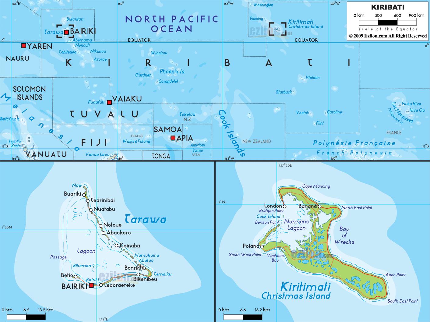

Description: Detailed large political map of Kiribati showing names of capital city, towns, states, provinces and boundaries with neighbouring countries.
 Kiribati
is located in Micronesia on the South Pacific, the
capital, Bairiki lies in the South Tarawa atoll, which
is composed of three main groups of islands in the
Central Pacific: Kiribati, the Line Islands and the
Phoenix Islands.
These sum up to a total of 33 islands scattered over 5 million sq km, the landscape of which is mainly low-lying coral atolls and costal lagoons, except Banaba; which is a coral formation that rises to 80 m. The official languages are Kiribati and English.
Tarawa, the capital is densely populated and near the
capital in Bonriki there is an international airport,
while in Betio there are several relics of war to be
visited.

Regional Directory of Australia
Information and guide about Australia and website listing.

Directory of the World
Information and guide about the World and website listing.

Regional Directory of United States of America
Information and guide about United States of America and websites with American topics.

Regional Directory of Europe
Information and guide about Europe and websites with European topics.

Regional Directory of Australia
Information and guide about Australia and websites with Australian topics.