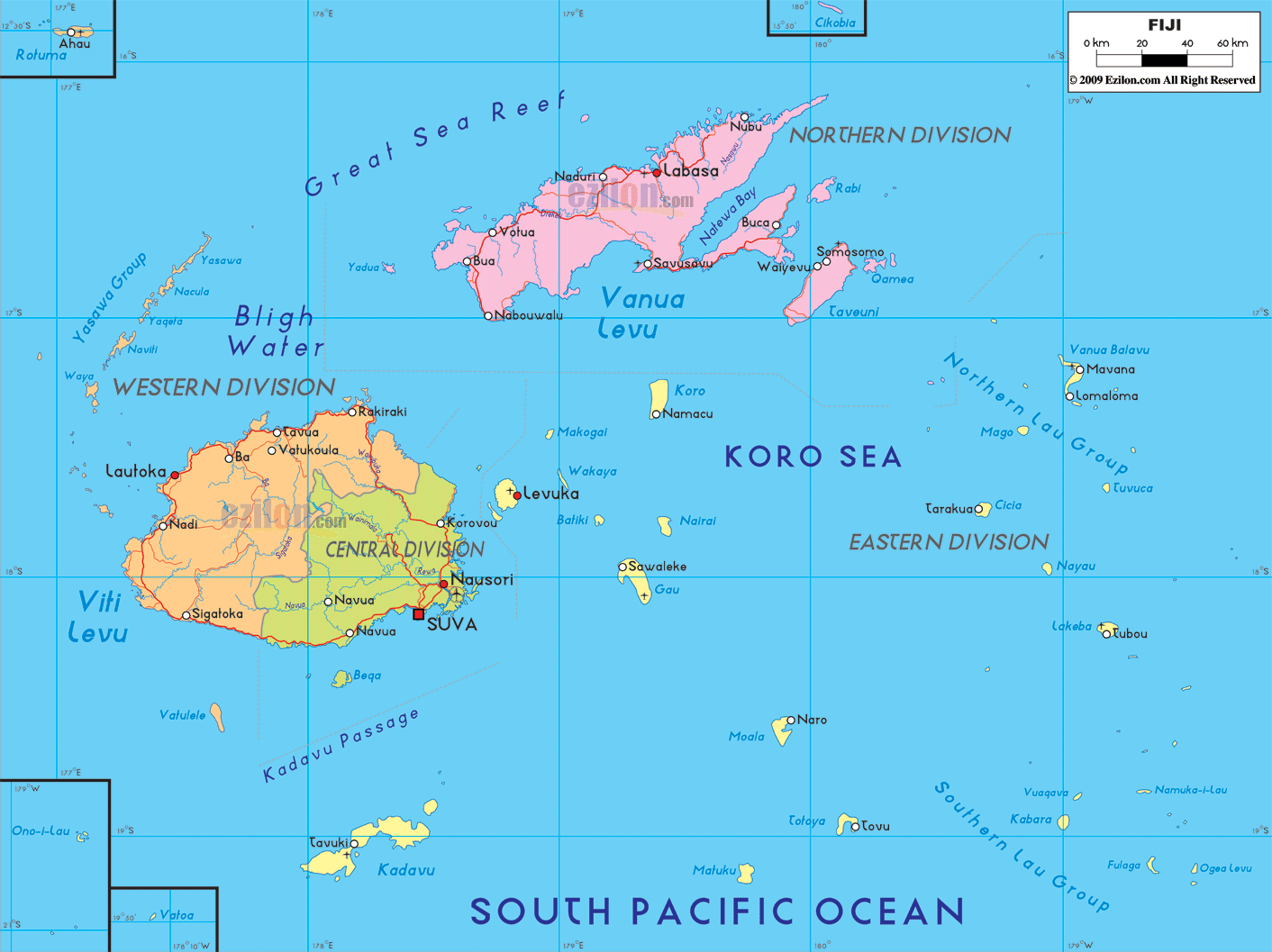

Description: Detailed large political map of Fiji showing names of capital city, towns, states, provinces and boundaries with neighbouring countries.
 Situated
in the South Pacific at approximately 3,000 km east of
Australia, the Fiji archipelago is formed by a group of
322 islands, only half of which are inhabited. The three
biggest islands are Viti Levu, Vanua Levu and Taveuni,
the former two are both extinct volcanoes that jut out
from the sea reaching 1,322 m above sea level with Mount
Victoria.
The Fiji overflow with thousands of streams and rivers
some of which are navigable, as well as hundreds of
islands all of volcanic origin and boast beautiful coral
reefs.

Physical Map of Fiji
Physical map and map image of Fiji.

Regional Directory of Australia
Information and guide about Australia and website listing.

Regional Directory of United States of America
Information and guide about United States of America and websites with American topics.

Regional Directory of Europe
Information and guide about Europe and websites with European topics.

Regional Directory of Australia
Information and guide about Australia and websites with Australian topics.