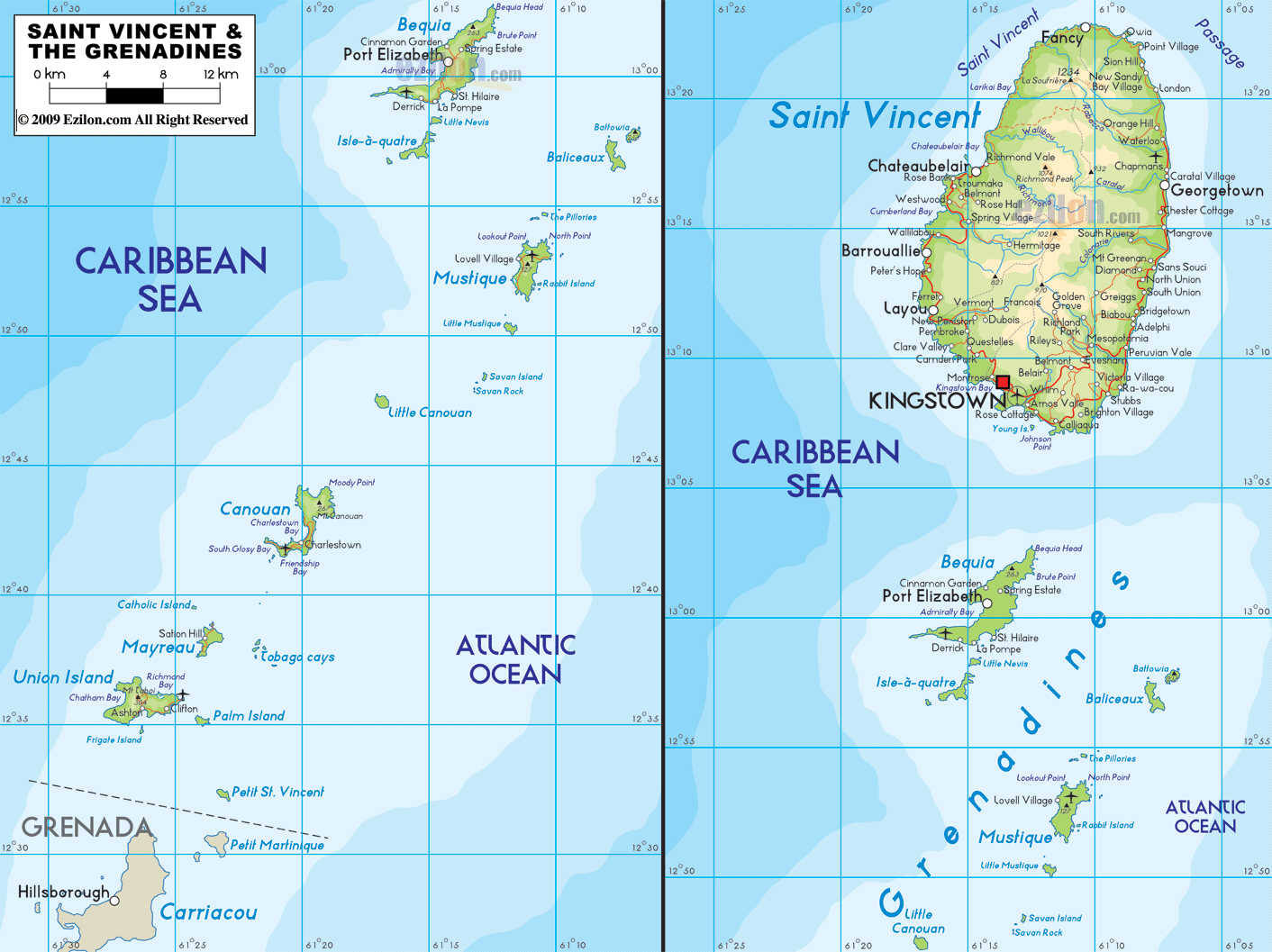

Description: The Physical Map of Saint Vincent and The Grenadines showing major geographical features like elevations, mountain ranges, deserts, lakes, plateaus, peninsulas, rivers, plains, landforms and other topographic features.
 St.
Vincent and the Grenadines is a country located in the
volcanic arc of the Caribbean Plate Tectonic. It is
placed on the windward side of the Lesser Antilles. The
total area taken up by the islands is 390 square
kilometers out of which 342.7 square kilometers. The
country lies between north latitude 13.16 degrees and
west longitude 61.23 degrees.
The highest point in the country is called Soufriere, it
is a volcanic peak which sits 1,234 meters above sea
level. However the lowest natural point rest at the mean
sea level on the Caribbean Sea.
The coastlines of the country are very different from
each other as the leeward end is full of beautiful sandy
beaches whereas the windward side is very rugged and
full of undulating terrain. The limited rainfall makes
vegetation very difficult and only 10% of the entire
land area is considered arable.
Forests and woodlands cover a massive 36%. Being located
at the very edge of the Caribbean Plate Tectonic, the
country is frequented by many earthquakes. It is also
located at the ending point of the Atlantic and
Caribbean hurricane belt. There are many hurricanes that
rock the country in the second half of the year.

Political Map of St. Vincent and the Grenadines
Political map and map image of St. Vincent and the Grenadines.

Regional Directory of Caribbean
Information and guide about Caribbean and website listing.

Regional Directory of United States of America
Information and guide about United States of America and websites with American topics.

Regional Directory of Europe
Information and guide about Europe and websites with European topics.

Regional Directory of Australia
Information and guide about Australia and websites with Australian topics.