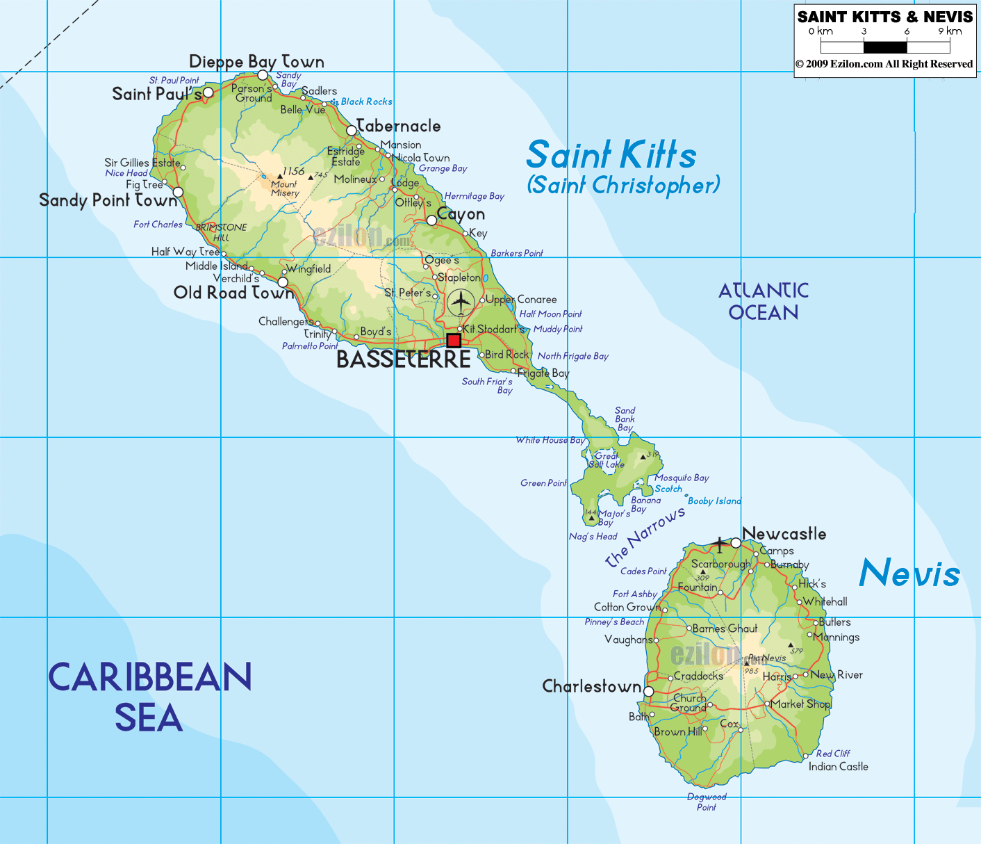

Description: The Physical Map of Saint Kitts and Nevis showing major geographical features like elevations, mountain ranges, deserts, lakes, plateaus, peninsulas, rivers, plains, landforms and other topographic features.
 St.
Kitts and Nevis are a group of two twin islands located
in the Caribbean Sea. The island is considered as a part
of Central America and Caribbean. The geographic
coordinates read as follows: north latitude 17.20
degrees and west longitude 62.45 degrees. The islands
together cover an area of just 261 square kilometers of
which 100% is land.
The highest natural peak in the country is known as
Mount Liamuiga and it rests at a height of 1156 meters
above sea level. The lowest point however rests at the
mean sea level on the Caribbean Sea. Both the islands
are volcanic in origin and were formed a long time ago.
The islands are actually mountain peaks of the immersed
mountain ranges which form the edge of Caribbean Plate
Tectonic. There are two very active volcanic peaks known
as the Liamuiga and the Nevis Peak.
The islands have identical terrains with raised beaches
and coastlines. The regular rainfall makes the land very
fertile along with the volcanic ash layering all the
time. 19.44% of the entire land area is considered to be
arable and good for growing crops. The time between July
and October every year is the time when hurricanes swirl
across the country.

Political Map of Saint Kitts and Nevis
Political map and map image of Saint Kitts and Nevis.

Regional Directory of Caribbean
Information and guide about Caribbean and website listing.

Regional Directory of United States of America
Information and guide about United States of America and websites with American topics.

Regional Directory of Europe
Information and guide about Europe and websites with European topics.

Regional Directory of Australia
Information and guide about Australia and websites with Australian topics.