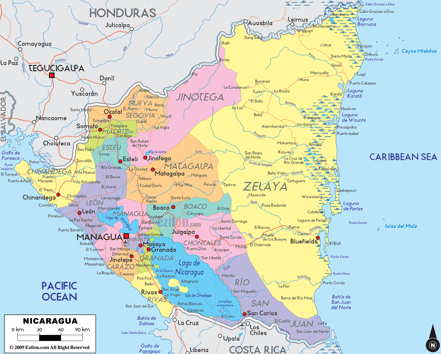

Description: Detailed large political map of Nicaragua showing names of capital city, towns, states, provinces and boundaries with neighbouring countries.
 Nicaragua
is a representative democratic republic and it is the
second poorest country in the Western Hemisphere. With
an area of 130,000 square kilometers, Nicaragua is
Central America's largest country. It has the Caribbean
Ocean on its east and the Pacific Ocean on its west.
Managua is its capital city where about 20% of the
nation's population resides. About twenty percent of
this nation has been made biological reserves, nature
reserves and national parks. This country is basically
dependent on agriculture and this sector makes up more
than half of Nicaragua total exports. The agricultural
exports yield about three hundred million dollars every
year.
The growth and development of the tourism industry in Nicaragua has positively influenced the other industries in the country such as the finance industry, the commercial industry and the agricultural industry.
Most of the
tourists who visit the country are from the United
States. It has been reported that about sixty thousand
tourists visit Nicaragua from the U.S each year and most
of them are tourists or business people.

Physical Map of Nicaragua
Physical map and map image of Nicaragua.

Regional Directory of Caribbean
Information and guide about Caribbean and website listing.

Regional Directory of United States of America
Information and guide about United States of America and websites with American topics.

Regional Directory of Europe
Information and guide about Europe and websites with European topics.

Regional Directory of Australia
Information and guide about Australia and websites with Australian topics.