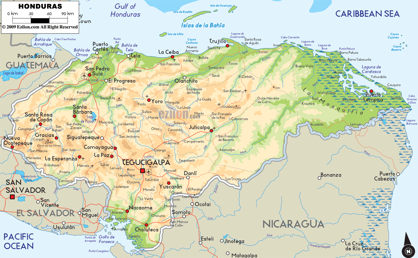

Description: The Physical Map of Honduras showing major geographical features like elevations, mountain ranges, gulf, sea, lakes, plateaus, peninsulas, rivers, plains, landforms and other topographic features.
 Honduras
is a country located in Central America. The country
shares a coastline with the Caribbean Sea to the North
and Northeast and a coastline with the North Pacific
Ocean to the South and Southwest. It is the second
largest country in Central America with an area of
110,000 square kilometers. The coastline with the
Caribbean Sea is 700 kilometers long and the one with
the Gulf of Fonseca is 153 kilometers in length.
The country lies between north latitude 14.1 degrees
and west longitude 87.2 degrees.
112,492 square kilometers of the total area is land and
only 200 square kilometers is taken up by water bodies.
The highest point in the country is known as Cerro Las
Minas which is 2,870 meters tall whereas the lowest
point is on the mea sea level on the Caribbean Sea. The
country has highlands in the center with low lying
coastal plains towards both the coasts. The Eastern and
Western Cordilleras run through the country before
blending in with the ranges in Guatemala.
The valley of the Rio Ulna is the largest in the
country. The Ulua is 400 kilometers long and also the
longest river in the country. Other important rivers
include the Choluteca, Lempa and Coco rivers.

Political Map of Honduras
Political map and map image of Honduras.

Regional Directory of Caribbean
Information and guide about Caribbean and website listing.

Regional Directory of United States of America
Information and guide about United States of America and websites with American topics.

Regional Directory of Europe
Information and guide about Europe and websites with European topics.

Regional Directory of Australia
Information and guide about Australia and websites with Australian topics.