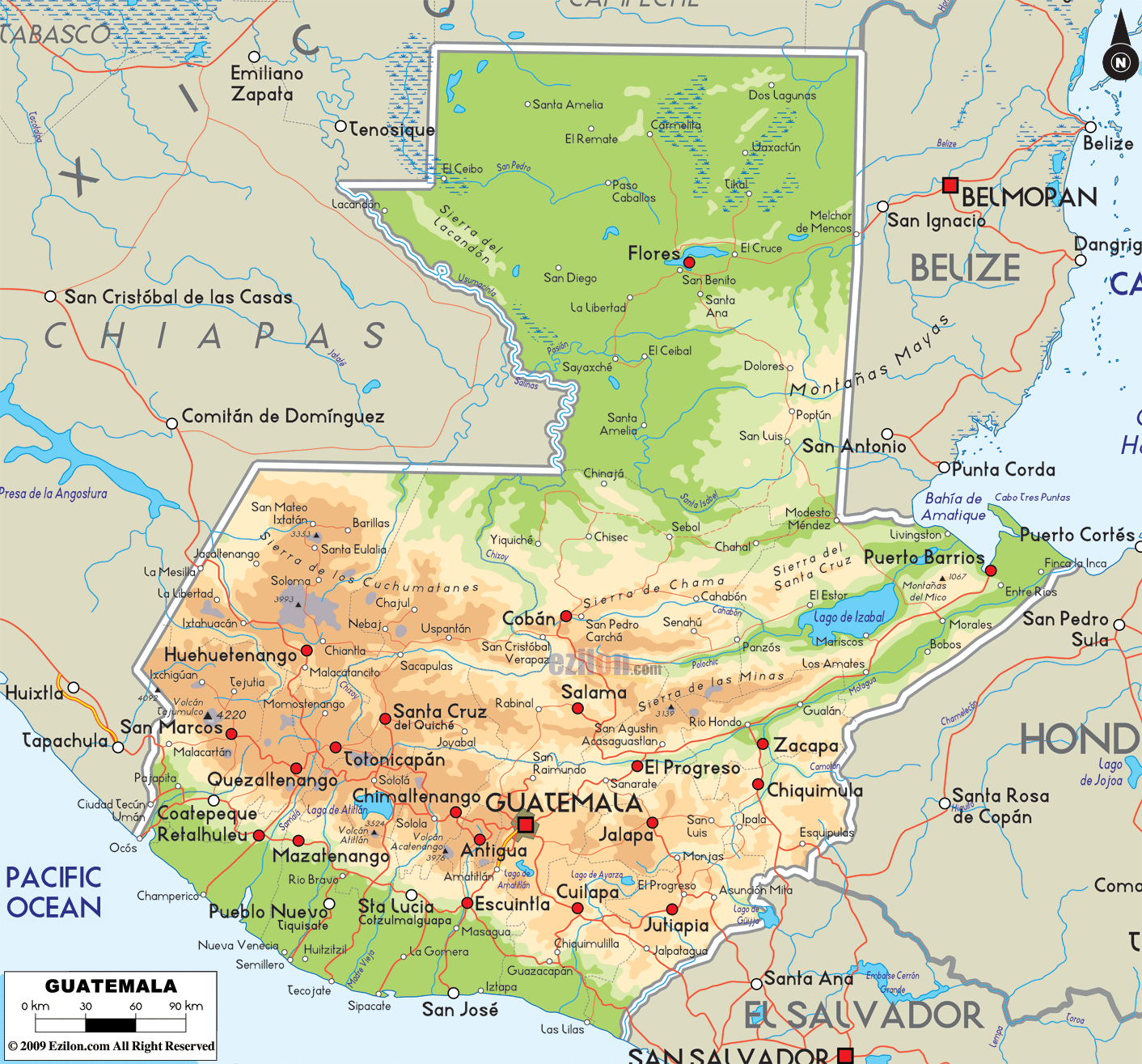

Description: The Physical Map of Guatemala showing major geographical features like elevations, mountain ranges, ocean, lakes, plateaus, peninsulas, rivers, plains, landforms and other topographic features.
 Guatemala
is a small country located in Central America, bordering
the North Pacific Ocean to the South and Southwest. The
country lies between 15.30 north latitude and 90.15 west
longitudes. It covers a total area of 108,890 square
kilometers of which 950 square kilometers is water and
the rest is all land.
The country shares a coastline of 400 kilometers. The highest peak in the country is known as Tajumulco Volcano and it is 4,220 meters above sea level whereas the lowest point is on the North Pacific Ocean at mean sea level. The Motagua River is the longest in the country and Lake Izabal is the largest by means of surface area with an area of 589.6 square kilometers.
Most river a shallow and short near the Pacific as most
of the long and deep rivers flow more towards the north
and central areas. Polochic, Rio Dulce and Satsun are
some of the most important rivers.

Political Map of Guatemala
Political map and map image of Guatemala.

Regional Directory of Caribbean
Information and guide about Caribbean and website listing.

Regional Directory of United States of America
Information and guide about United States of America and websites with American topics.

Regional Directory of Europe
Information and guide about Europe and websites with European topics.

Regional Directory of Australia
Information and guide about Australia and websites with Australian topics.