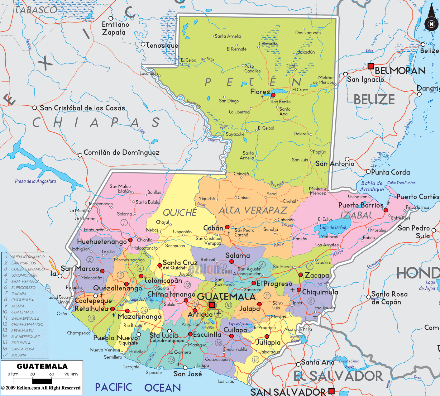

Description: Detailed large political map of Guatemala showing names of capital city, towns, states, provinces and boundaries with neighbouring countries.
 Situated
in Central America Guatemala touches borders with
Mexico, El Salvador, Belize and Honduras and overlooks
both the Caribbean Sea and the Pacific Ocean. With
Guatemala City as its capital and Spanish as the
official language, this country offers heavily forested
and mountainous landscapes.
Guatemala is a volcanic country with numerous volcanoes
along the southern highlands, three of which are still
active; this is where the fertile land lies and where
the higher concentration of the population lives. A
large part of the country is covered by subtropical
forests, scattered with sulphurous lakes and flowing
with rivers, a paradise for wildlife and nature lovers.
The proliferating wilderness is not the only one amongst
the riches of Guatemala, for the country boasts
spectacular Mayan archaeological sites, relics of the
ancient Mayan Civilization as well as monuments and
buildings left by the Spanish conquistadors during the
17th century.

Physical Map of Guatemala
Physical map and map image of Guatemala.

Regional Directory of Caribbean
Information and guide about Caribbean and website listing.

Regional Directory of United States of America
Information and guide about United States of America and websites with American topics.

Regional Directory of Europe
Information and guide about Europe and websites with European topics.

Regional Directory of Australia
Information and guide about Australia and websites with Australian topics.