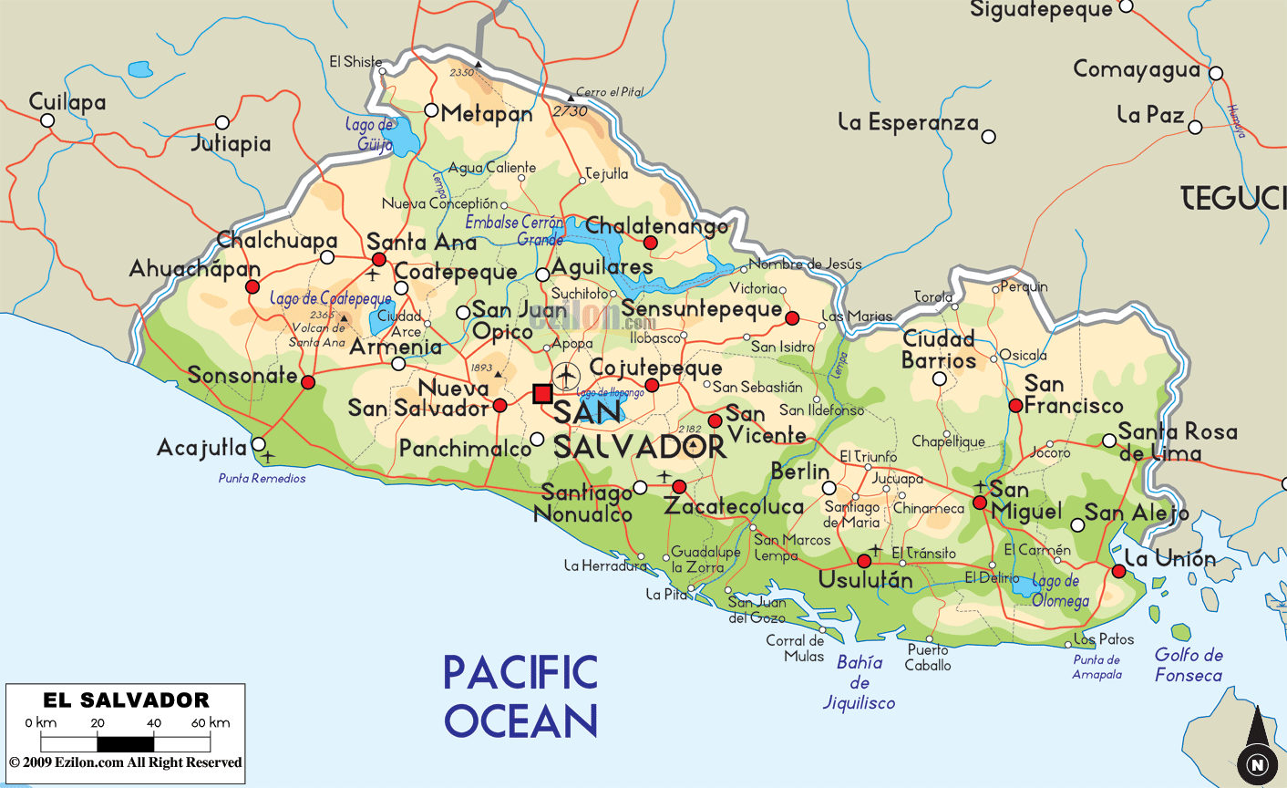

Description: The Physical Map of El Salvador showing major geographical features like elevations, mountain ranges, ocean, lakes, plateaus, peninsulas, rivers, plains, landforms and other topographic features.
 El
Salvador is a small country based in Central America.
The country shares a coastline with the North Pacific
Ocean to the south and southwest. It is the smallest
Central American country and also the only one not to
have a coastline with the Caribbean Sea. The geographic
points read as follows: 13.50 degrees north latitude and
88.55 degrees west longitude. The country sits on one of
the most active tectonic plates on earth and frequented
by many earthquakes and volcanoes.
The country's total area measures in at 23,040 square
kilometers of which 22,720 square kilometers in land and
320 square kilometers is water. The country is bisected
towards the west by two major mountain ranges which are
parallel to each other. The northern range is known as
the Sierra Madre Range and the southern is a group of
more than 20 volcanic peaks. In between is a central
plateau beside which are the plains towards the Pacific.
Rio Lempa is the longest and most important river in the
country and also a part of the 300 rivers running in the
nation. The highest peak is known as Cerro El Pital,
measuring in at 2730 meters above sea level, whereas the
lowest point rests at the mean sea level on the Pacific
Ocean.

Political Map of El Salvador
Political map and map image of El Salvador.

Regional Directory of Caribbean
Information and guide about Caribbean and website listing.

Regional Directory of United States of America
Information and guide about United States of America and websites with American topics.

Regional Directory of Europe
Information and guide about Europe and websites with European topics.

Regional Directory of Australia
Information and guide about Australia and websites with Australian topics.