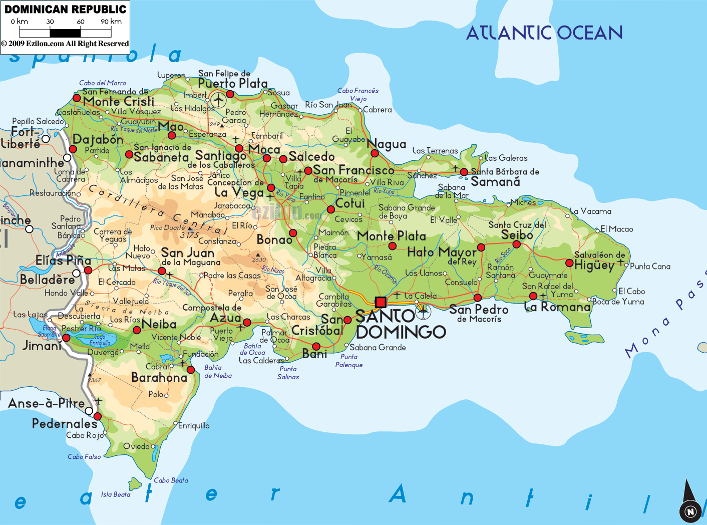

Description: The Physical Map of Dominican Republic showing major geographical features like elevations, mountain ranges, ocean, lakes, plateaus, peninsulas, rivers, plains, landforms and other topographic features.
 The
Dominican Republic is a country situated in the West
Indies, between the Atlantic Ocean and Caribbean Sea.
The country lies between north latitude 19 degrees and
west longitude 70.40 degrees. It covers a total area of
48,442 square kilometers of which 48,600 square
kilometers is land and 350 square kilometers is taken up
by the water bodies. The country has a collective
coastline of 1,288 kilometers.
The
Dominican Republic is a country situated in the West
Indies, between the Atlantic Ocean and Caribbean Sea.
The country lies between north latitude 19 degrees and
west longitude 70.40 degrees. It covers a total area of
48,442 square kilometers of which 48,600 square
kilometers is land and 350 square kilometers is taken up
by the water bodies. The country has a collective
coastline of 1,288 kilometers.
The highest peak of the country is known as the Pico
Duarte as it rests 3,098 meters above sea level. The
lowest natural point in the country is known as Lago
Enriquillo, which is a lake located in southwest part of
the country.
The country's landscape is filled with high mountains,
rocky highlands and arable plains. The three areas are
patched all over the country with no particular pattern.
The most important rivers in the country are the Ozama,
Rio Yaque del Norte and Jimani rivers. The Yaque del
Norte is the longest river in the country as it flows
for 298 kilometers. However the Ozama River is the most
important river in the country. Its origin is based high
on the Sierra de Yamasa Range. The river also has a few
tributaries in the country.

Political Map of Dominican Republic
Political map and map image of Dominican Republic.

Regional Directory of Caribbean
Information and guide about Caribbean and website listing.

Regional Directory of United States of America
Information and guide about United States of America and websites with American topics.

Regional Directory of Europe
Information and guide about Europe and websites with European topics.

Regional Directory of Australia
Information and guide about Australia and websites with Australian topics.