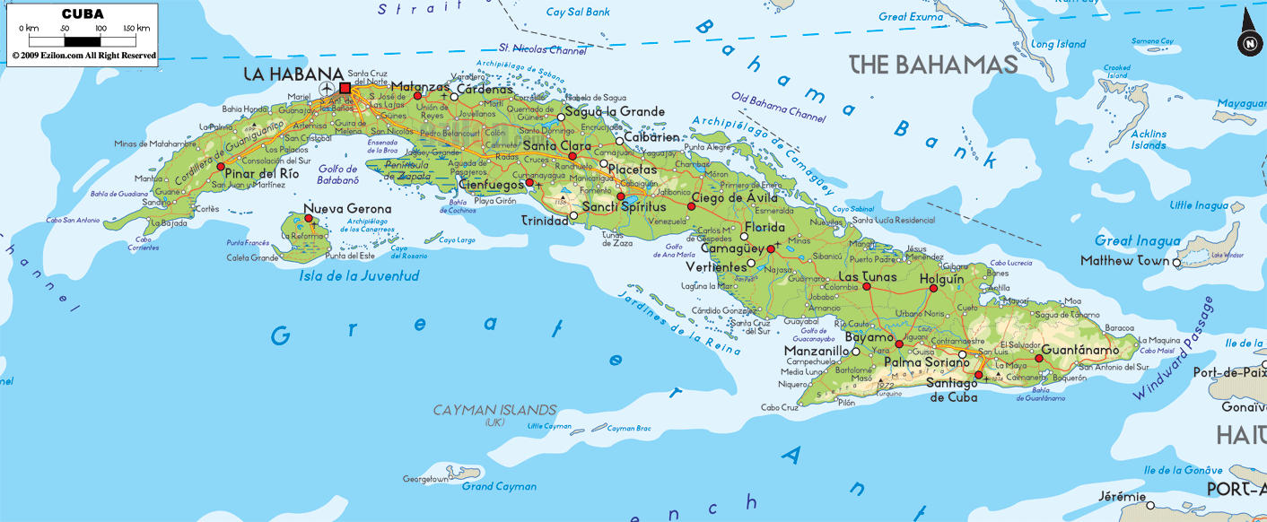

Description: The Physical Map of Cuba showing major geographical features like elevations, mountain ranges, ocean, lakes, plateaus, peninsulas, rivers, plains, landforms and other topographic features.
 Cuba
is an island country situated in the Caribbean Sea and
it lies between north latitude 21.30 and west longitude
80 degrees. The country covers a total land area of
about 109,884 square kilometers. The total area
including territorial and coastal waters amounts up to
110,860 square kilometers.
The country has a coastline
of 5,746 kilometers. The highest point on land is known
as Pico Turquino and it is 1,974 meters above sea level
and it is a part of the Sierra Maestra Range. The lowest
point however lies at mean sea level with the Caribbean
Sea and Atlantic Ocean. The island measures a mere 31
kilometers at its narrowest point.
It is the largest Caribbean country by means of land
area. The southeast part of the country contains plains,
rolling hills and mountains. Of all the mountain ranges
in the country the most important ones are the Sierra
Maestra, Sierra Cristal, Escambray Mountains and the
Sierra del Rosario.
Zapata Swamp is the largest marshy swamp land in the
country covering an area of about 4,520 square
kilometers. There are no rivers of streams in the
country. The largest fresh water reservoir is known as
the Laguna de Leche. Another manmade reservoir by the
name Zaza Reservoir also exists.

Political Map of Cuba
Political map and map image of Cuba.

Regional Directory of Caribbean
Information and guide about Caribbean and website listing.

Regional Directory of United States of America
Information and guide about United States of America and websites with American topics.

Regional Directory of Europe
Information and guide about Europe and websites with European topics.

Regional Directory of Australia
Information and guide about Australia and websites with Australian topics.