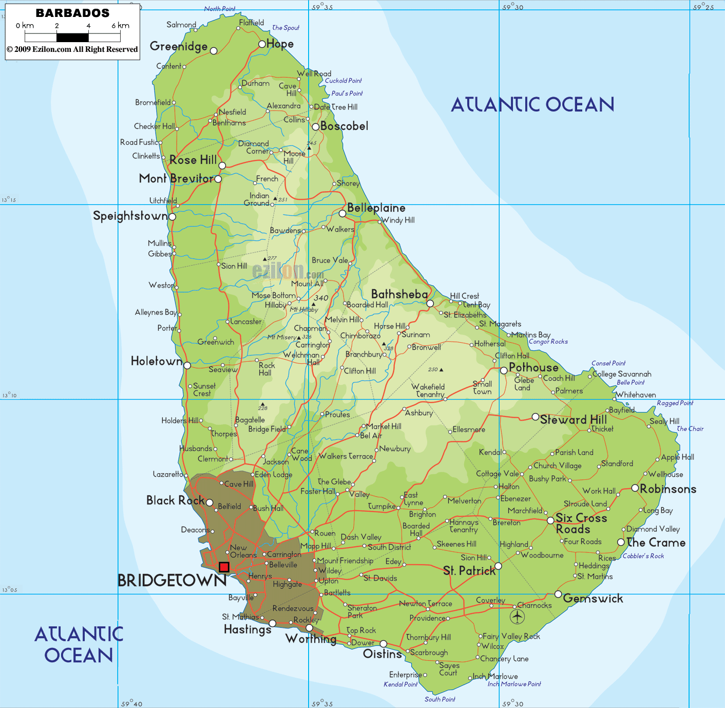

Description: The Physical Map of Barbados showing major geographical features like elevations, mountain ranges, ocean, plateaus, peninsulas, rivers, plains, landforms and other topographic features.
 Barbados
is an island located in the North Atlantic Ocean and it
lies between north latitude 13.10 degrees and west
longitude 59.32 degrees. The island lies towards the
east of the windward side of the Lesser Antilles. The
total area covered up by this island is 70000 square
kilometers with a coastline spanning 97 kilometers. A
mere 431 square kilometers is taken up by land and 69569
square kilometers is occupied by water. The country
measures 34 kilometers from top to bottom and 23 from
ear to ear.
The highest point in the country is called Mount Hillaby
which sits at a height of 336 meters whereas the lowest
point rests at mean sea level on the Atlantic Ocean.
The terrain along the coasts showcase a few rolling
hills whereas the central lands are low lying with a
steep plateau rising in the midst. The primary mountain
range running in the country is known as the Christ
Church Range. Most of the limestone surface of the
country is used to grow sugarcanes.
Lying between the tropics, the country experiences
pleasant weather all year round frequented by the north
east trade winds. The country has 5 major rivers, of
which 3 drain into the Atlantic Ocean and 2 drain into
the Caribbean Sea. The Bruce Vale and Constitution
Rivers are the most important.

Political Map of Barbados
Political map and map image of Barbados.

Regional Directory of Caribbean
Information and guide about Caribbean and website listing.

Regional Directory of United States of America
Information and guide about United States of America and websites with American topics.

Regional Directory of Europe
Information and guide about Europe and websites with European topics.

Regional Directory of Australia
Information and guide about Australia and websites with Australian topics.