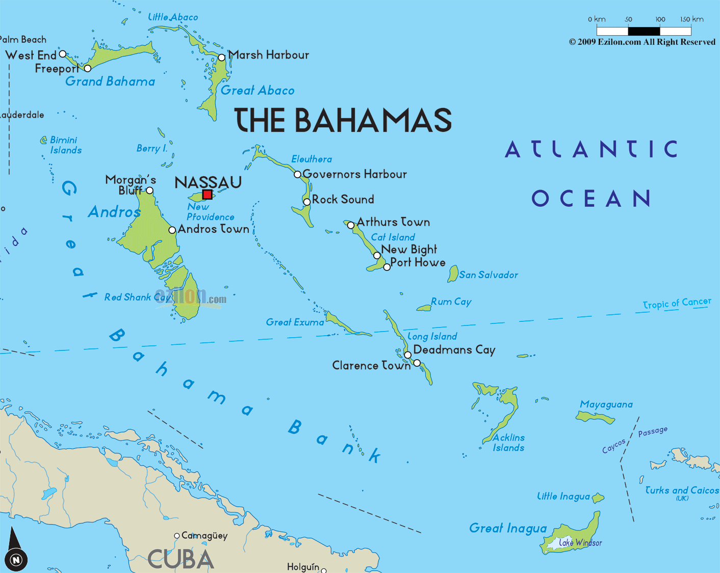

Description: The Physical Map of Bahamas showing major geographical features like elevations, ocean, lakes, plateaus, peninsulas, rivers, plains, landforms and other topographic features.
 The
Bahamas is an archipelago of about 700 atolls and
islands. It is situated in the West Atlantic Ocean. The
country lies between north latitude 25.4 degrees and
west longitude 77.20 degrees. The total area covered by
the country measures up to be 13940 square kilometers
out of which 10070 square kilometers is land and 3870
square kilometers is occupied by water bodies. The
islands and atolls together make up a coastline which is
3542 kilometers in length.
Most of the islands are low lying and the highest point
is known as Mount Alverina which sits at a mere height
of 63 meters above sea level. The lowest point however
sits at mean sea level on the Atlantic Ocean.
The terrain is dominated by the low lying coral
formations with a few very short hills all around. The
climates are particularly tropical and are frequented by
the Gulf Stream. The country lacks the presence of
rivers but it does have many tidal creeks which look
like rivers. All the creeks are present on the Andros
Islands except one which is on Eleuthera Island. The
major creeks include: Staniard, Fresh, Sandy, River
Lees, Hawk, Timber and Starve Creek. Starve Creek is the
only one to be situated on a separate island.

Road Map of Bahamas
Road map and map image of Bahamas.

Regional Directory of Caribbean
Information and guide about Caribbean and website listing.

Regional Directory of United States of America
Information and guide about United States of America and websites with American topics.

Regional Directory of Europe
Information and guide about Europe and websites with European topics.

Regional Directory of Australia
Information and guide about Australia and websites with Australian topics.