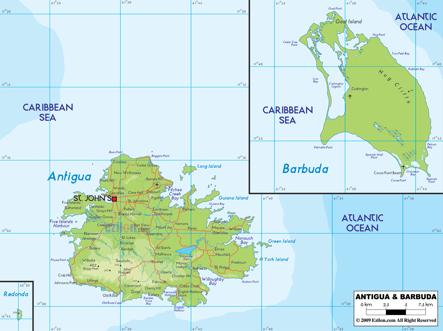

Description: Physical map of Antigua and showing, rivers, lakes, elevations and other topographic features.
 Antigua
and Barbuda is a country located in North America in the
sub region known as the Caribbean. It lies between north
latitude 17.3 degrees and west longitude 61.48 degrees.
The group of islands lies on the rain shadow area of the
Lesser Antilles. The islands together take up an area of
442.6 square kilometers. The collective coastline is 153
kilometers long.
The terrain of the country is mostly low lying mainly
formed by limestone instead of volcanic activity. Mount
Obama is the highest peak in the country which is 402
meters high. The lowest part of the country lies at mean
sea level on the Atlantic Ocean.
The country is surrounded by coral reefs and shoals.
There are no permanent rivers in the country as rainfall
is very low. The country lies very close to the
hurricane belt of the Atlantic which is the main cause
of the hurricanes frequenting the country. There are
also a few droughts each year due to the scanty
rainfall. The sandy shores extend inward which causes
problems in vegetation.
The country mostly has shrubs except the central plain
in Antigua. The main reason for fertility is the huge
amount of volcanic ash. 11% of Antigua is forested owing
to the Acacia and Mahogany trees along with a few red
and white cedar trees.

Political Map of Antigua and Barbuda
Political map and map image of Antigua and Barbuda.

Regional Directory of Caribbean
Information and guide about Caribbean and website listing.

Regional Directory of United States of America
Information and guide about United States of America and websites with American topics.

Regional Directory of Europe
Information and guide about Europe and websites with European topics.

Regional Directory of Australia
Information and guide about Australia and websites with Australian topics.