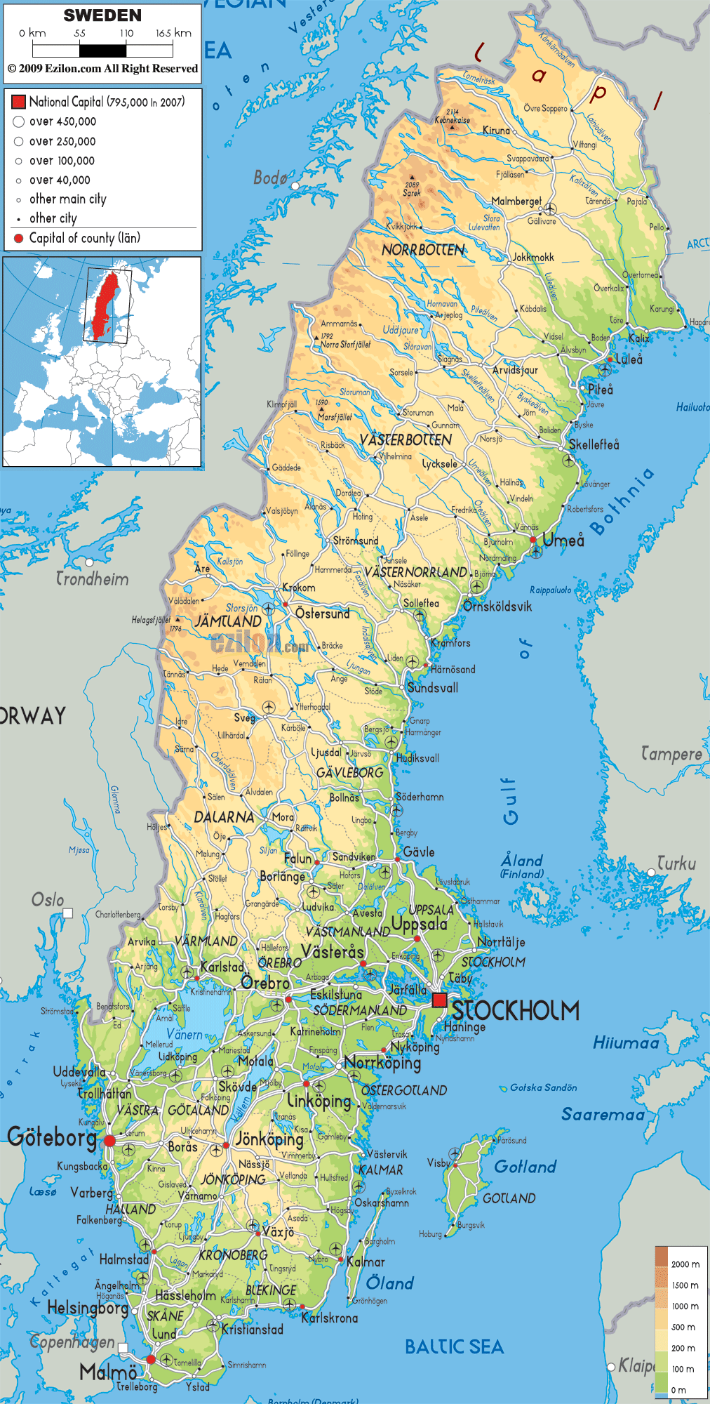

Description: The physical map of Sweden showing major geographical features like elevations, mountain ranges, seas, lakes, plateaus, peninsulas, rivers, plains, landforms and other topographic features.
 Sweden
officially known as the Kingdom of Sweden is a
Scandinavian country situated in Northern Europe.
It has a total area of 449,964 square kilometres and it
is the 55th largest country in the world. In the
European Union it is the third largest country.
Baltic Sea and Gulf of Bothnia lies to the east and Scandinavian mountain chain in the west. To its north-east is Finland. Denmark, Germany, Poland, Russia, Lithuania, Latvia and Estonia has maritime borders with Sweden. The longest border without interruption is with Norway which is 1,619 kilometres long.
The highest point or mountain in Sweden is Kebnekaise.
Sweden's largest islands are Gotland and Öland. The
largest lakes are Vattern and Vanern. Vanern comes at
number three in terms of size in whole of Europe.
North of the Sweden is covered by forests and the south
by agriculture and so the southern part is heavily
habituated. The eastern part of the Scandinavian Plateau
is formed by Sweden.
The bay of Lake Hammarsjön at −2.41 m is the lowest
point in Sweden located in Kristianstand. The central
Svealand, the northern Norrland and southern Götaland
are the three main lands which are formed by the
grouping of the twenty five landscapes or provinces.

Political Map of Sweden
Political map and map image of Sweden.

Road Map of Sweden
Road map and map image of Sweden.

Regional Directory of United States of America
Information and guide about United States of America and websites with American topics.

Regional Directory of Europe
Information and guide about Europe and websites with European topics.

Regional Directory of Australia
Information and guide about Australia and websites with Australian topics.