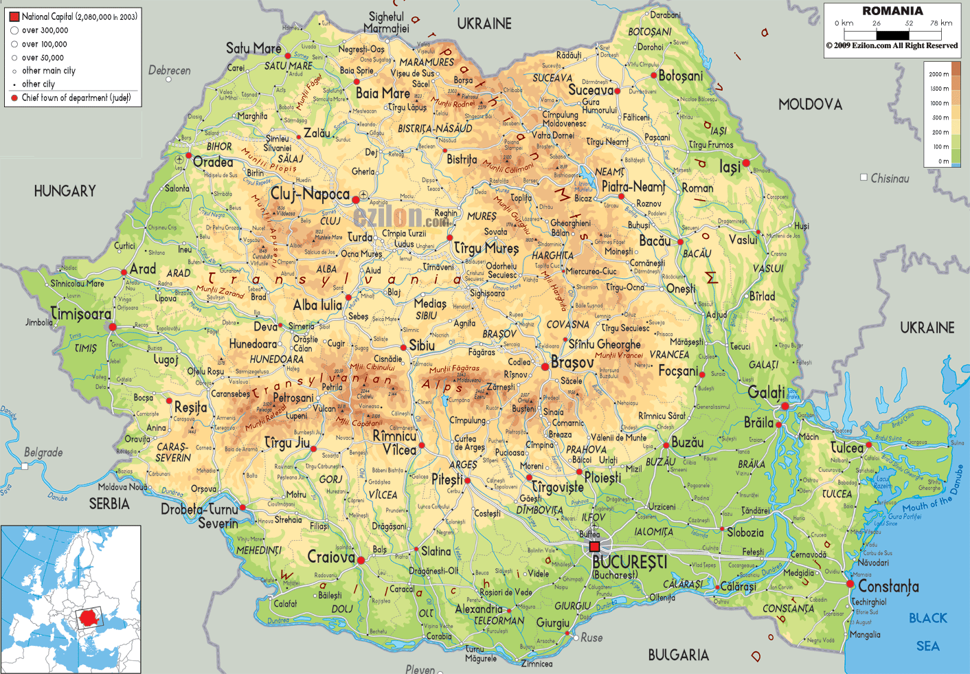

Description: The physical map of Romania showing major geographical features like elevations, mountain ranges, seas, lakes, plateaus, peninsulas, rivers, plains, landforms and other topographic features.
 Romania
is the 12th largest country in Europe and covers an area
of 238400 square kilometers. It is situated at the
convergence of Southeastern and Central Europe.
It is situated at the midpoint of the North Pole and the
Equator. The country also has a coastline spanning 245
kilometers which is bordered by the Mediterranean Sea
and Atlantic Ocean.
The Moldoveanu Mountain of the Fagaras Range is the
tallest mountain in the country measuring up at 2544
meters. The second tallest mount is also in the same
range and is called Negoiu (2535 m).
The Danube River runs for 1075 kilometers in the country
and all other rivers are directly or indirectly its
tributaries. The river drains itself into the Black Sea.
However the most important rivers are: Olt River, Mures
River, Prut River and Siret River. The rivers branch out
in three directions from the central Carpathian Crown
watering the entire country. The river are fed by
monsoons and melting snow.

Political Map of Romania
Political map and map image of Romania.

Road Map of Romania
Road map and map image of Romania.

Regional Directory of United States of America
Information and guide about United States of America and websites with American topics.

Regional Directory of Europe
Information and guide about Europe and websites with European topics.

Regional Directory of Australia
Information and guide about Australia and websites with Australian topics.