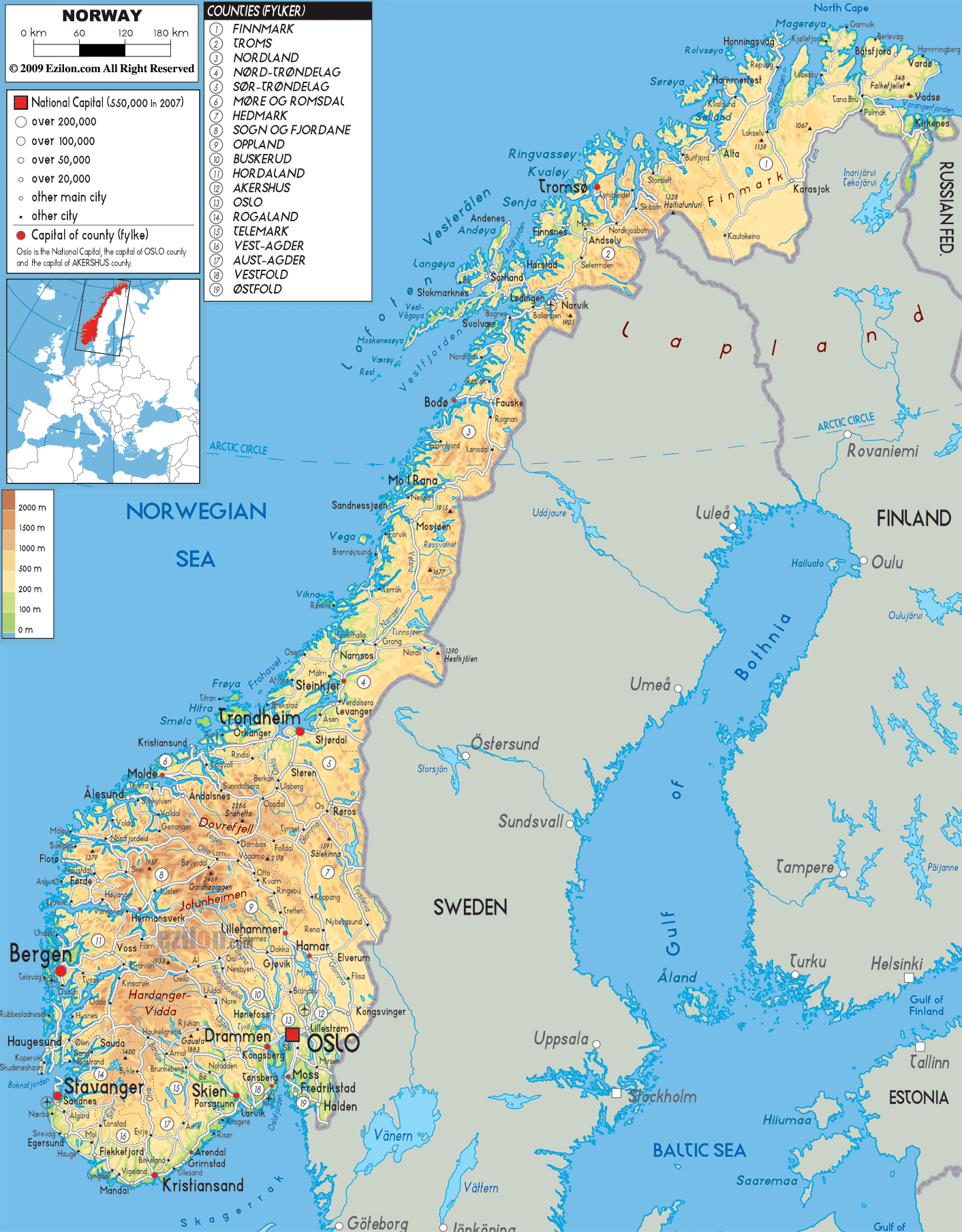

Description: The physical map of Norway showing major geographical features like elevations, mountain ranges, seas, lakes, plateaus, peninsulas, rivers, plains, landforms and other topographic features in the counties of Norway.
 Norway
is a country located in the Scandinavian Peninsula which
is situated in North Europe. The country is bordered by
the North Sea to the southwest and the Skagerrak inlet
in the south. The north holds the Atlantic Sea whereas
west is covered by the Barents Sea.
Norway is the country with one of the longest and most
indented coastlines with about 50000 islands lining the
coast. The country lies between north latitudes 58 and
71 degrees and east longitudes 5 and 31 degrees.
The country is one of the most northern based in Europe
and is dominated by high rocky terrain owing to the
Scandinavian Mountains. Most of the country sits above
the tree line with an average elevation of about 460
meters.
The total area covered by the country is 324220 square
kilometers of which 307860 square kilometers is land and
the rest is water.
The Scandinavian Mountains are the most dominant
features of the country and they also form the Lyngen
Alps.
The Glomma River is the longest in the country and runs
for nearly 380 kilometers. Mjosa is the country’s
largest lake with a surface area of 362 square
kilometers. The Hornindalsvatnet is the deepest lake in
the country and all of Europe with a depth of 514 meters.

Political Map of Norway
Political map and map image of Norway.

Road Map of Norway
Road map and map image of Norway.

Regional Directory of United States of America
Information and guide about United States of America and websites with American topics.

Regional Directory of Europe
Information and guide about Europe and websites with European topics.

Regional Directory of Australia
Information and guide about Australia and websites with Australian topics.