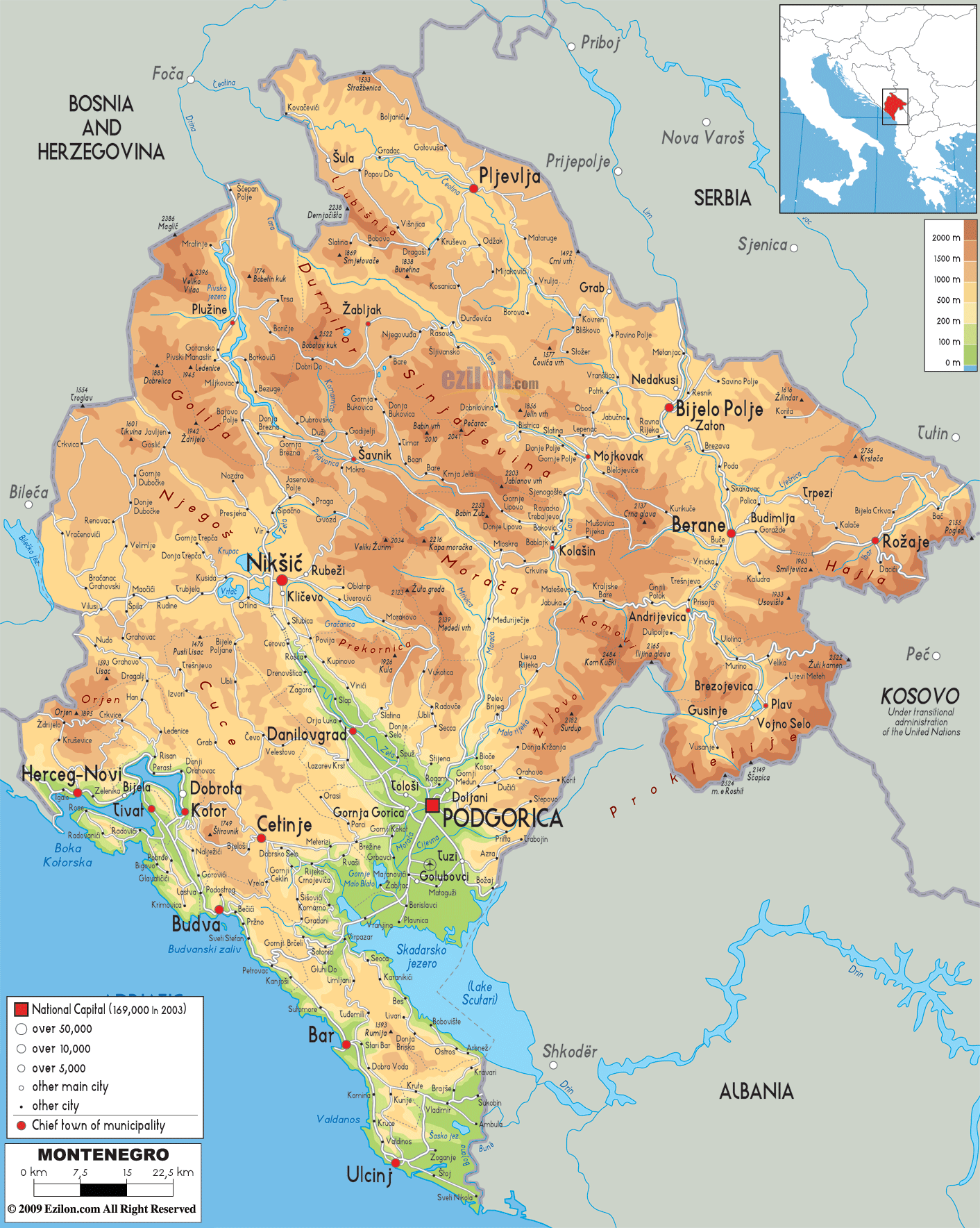

Description: The physical map of Montenegro showing major geographical features like elevations, mountain ranges, seas, lakes, plateaus, peninsulas, rivers, plains, landforms and other topographic features.
 Montenegro
is a small country located in the southwest Balkan
region of Europe. The country borders Croatia, Serbia,
Bosnia and Herzegovina, Albania, Kosovo and the Adriatic
Sea. The country spans an area of 13812 square
kilometers. Although small, the country is diverse when
it comes to the terrain.
The northern segment of the country has high mountains
whereas the central and western regions are filled with
plains, caves and a narrow coastline. Mount Bobotov Kuk
is the highest peak in the country and rises to a height
of 2523 meters above sea level. It is a part of the
Durmitor Mountain Range.
The Valley of the Zeta River holds the lowest point in
the country. The river Zeta flows very high above sea
level at about 450 meters. The Zeta River also drains
the two dominant plains ion the country known as the
Bjelopavlici Plain and the Zeta Plain.
The northern part of the country is watered by rivers
Tara and Lim which join the Danube River after draining
into the Drina River. The Tara is the longest river and
flows for 144 kilometers.The southern rivers all empty
themselves into the Adriatic Sea. Lake Skadar also known
as Lake Scutari is the largest lake in all of the
peninsula.

Political Map of Montenegro
Political map and map image of Montenegro.

Road Map of Montenegro
Road map and map image of Montenegro.

Regional Directory of United States of America
Information and guide about United States of America and websites with American topics.

Regional Directory of Europe
Information and guide about Europe and websites with European topics.

Regional Directory of Australia
Information and guide about Australia and websites with Australian topics.