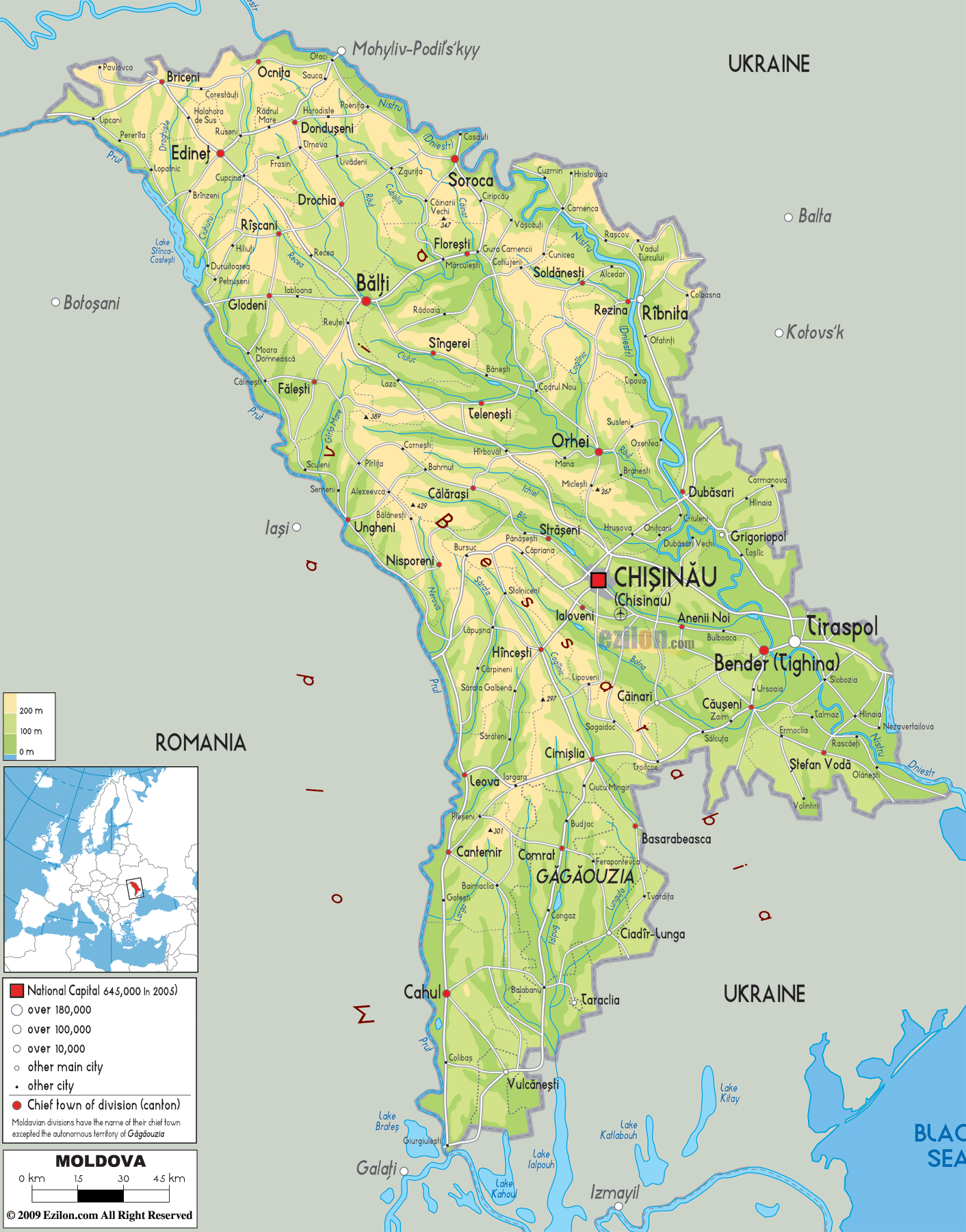

Description: The physical map of Moldova showing major geographical features like elevations, lakes, plateaus, peninsulas, rivers, plains, landforms and other topographic features.
 Moldova
is a small country located in the southeastern part of
the European Continent. The country lies between north
latitude 47 degrees and east longitude 29 degrees.
The total area covered by the country is 33851 square
kilometers out of which 32891 square kilometers is land
and the rest is water. The country is landlocked and
hence has no coastlines.
Most of the country falls between the areas covered by
its two major rivers called the Prut and Dniester. The
latter runs in the eastern part of the country whereas
the former runs along the west. The Danube River touches
the southernmost tip of the country.
The lowest point of the country lies 2 meters under the
Nistru River. Balanesti Hill is the highest natural peak
and measures in at 430 meters above sea level. Most of
the country’s area is filed with plateaus and hills
which are cut at many points by the numerous rivers and
streams present.
The Carpathian Mountains run into Moldova and become the
Moldovian Plateau. The northern part of the country is
dominated by the Dniester Hills which are divided into
the Moldovian Hills and the Dniester Ridge. The
Moldovian Plain is divided into Balti Steppe and Middle
Prut Valley which is full of forests.

Political Map of Moldova
Political map and map image of Moldova.

Road Map of Moldova
Road map and map image of Moldova.

Regional Directory of United States of America
Information and guide about United States of America and websites with American topics.

Regional Directory of Europe
Information and guide about Europe and websites with European topics.

Regional Directory of Australia
Information and guide about Australia and websites with Australian topics.