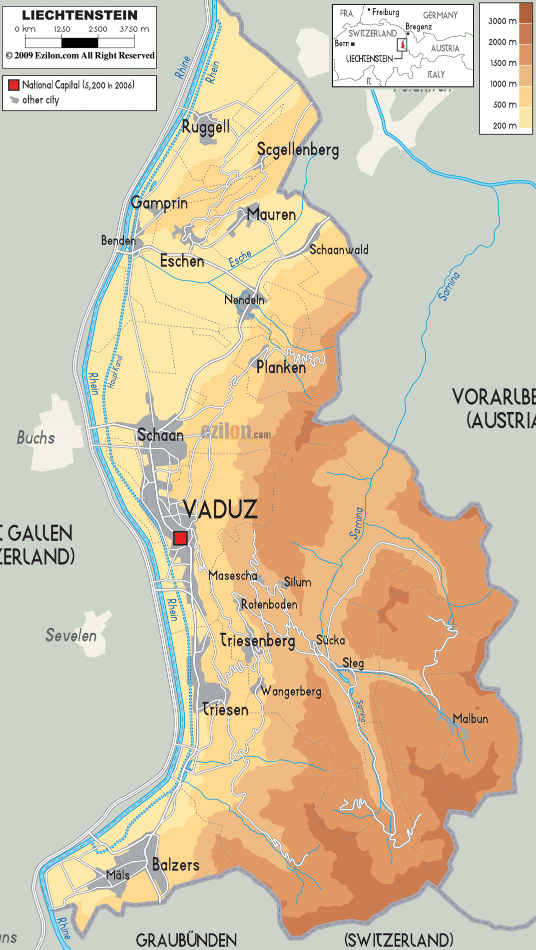

Description: The Physical Map of Liechtenstein showing major geographical features like elevations, rivers, mountain ranges, lakes, plateaus, peninsulas, plains, landforms and other topographic features.
 Liechtenstein
is a country filled with hills and mountains located in
the central Europe. The geographic coordinates of the
country are 47.10 degree north latitude and 9.32 degrees
east longitude. The country spans an area of 160 square
kilometers all of which is land.
The terrain of the country is rocky owing to the
dominant Alps Mountain Range. The western quarter of the
country contains the valley. The largest and only lake
in the country is called Lake Gampriner Seele.
The highest peak in the country is 2599 meters tall and
is called Mount Grauspitz. The second highest peak
however is just 25 meters shorter than the first and is
called Naafkopf. The lowest point however is down under
at 429 meters below the surface of the sea.
The country also has an abundance of forests containing
trees like Spruce, Pine and Fir. The trees also prevent
extensive soil erosion.
The Rhine River flows across the country and drains into
the North Sea and runs along the Swiss border.
The Samina is another important river in Liechtenstein which originates in the country and flows into Austria. The most dominant range of mountains in the country is the Ratikon Range which is a part of the Eastern Alps.

Political Map of Liechtenstein
Political map and map image of Liechtenstein.

Road Map of Liechtenstein
Road map and map image of Liechtenstein.

Regional Directory of United States of America
Information and guide about United States of America and websites with American topics.

Regional Directory of Europe
Information and guide about Europe and websites with European topics.

Regional Directory of Australia
Information and guide about Australia and websites with Australian topics.