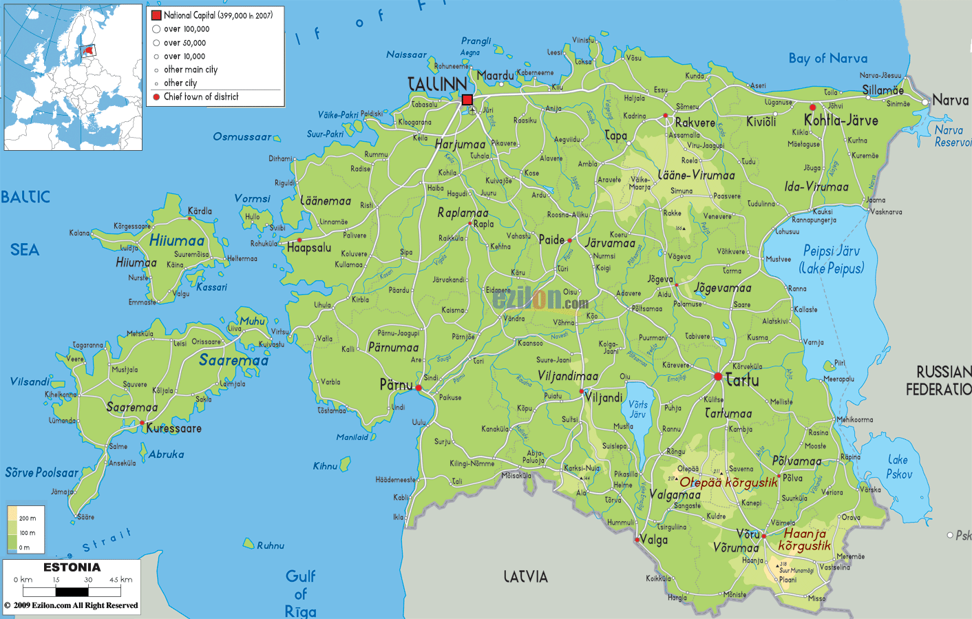

Description: The physical map of Estonia showing major geographical features like elevations, seas, lakes, plateaus, peninsulas, rivers, plains, landforms and other topographic features. Left top side in this map also pinpoint the exact location of Estonia in Europe.
 Estonia
is a country based in the northwestern part of Europe.
It lies between north latitude 57.3 and 59.5 degrees and
east longitude 21.5 and 28.1 degrees. The country
separates the Gulf of Finland from Latvia and Russia. It
shares its international boundaries with Russia on the
east and Latvia in the south with the Baltic Sea to the
west.
The flat country spreads across 45226 kilometers square. On its coastline near the Baltic Sea, the country has over 1500 islands. Suur Munamagi or Egg Mountain is the highest peak in the country and stands tall at 318 meters above sea level. It lies in the hilly southeast region. The country also boasts about the natural and artificial lakes which sum up to more than 1500.
The largest lake however is Lake Peipus and is
present as a bordering water body near the Estonian and
Russian border. Lake Vortsjarv is the second largest
lake and is located at the heart of the country.
Of the many rivers, the Narva and Emajogi are the most
important ones running in the country. The border shared
with Latvia is 267 kilometers in length whereas the one
shared with Russia is 290 kilometers long.

Political Map of Estonia
Political map and map image of Estonia.

Road Map of Estonia
Road map and map image of Estonia.

Regional Directory of United States of America
Information and guide about United States of America and websites with American topics.

Regional Directory of Europe
Information and guide about Europe and websites with European topics.

Regional Directory of Australia
Information and guide about Australia and websites with Australian topics.