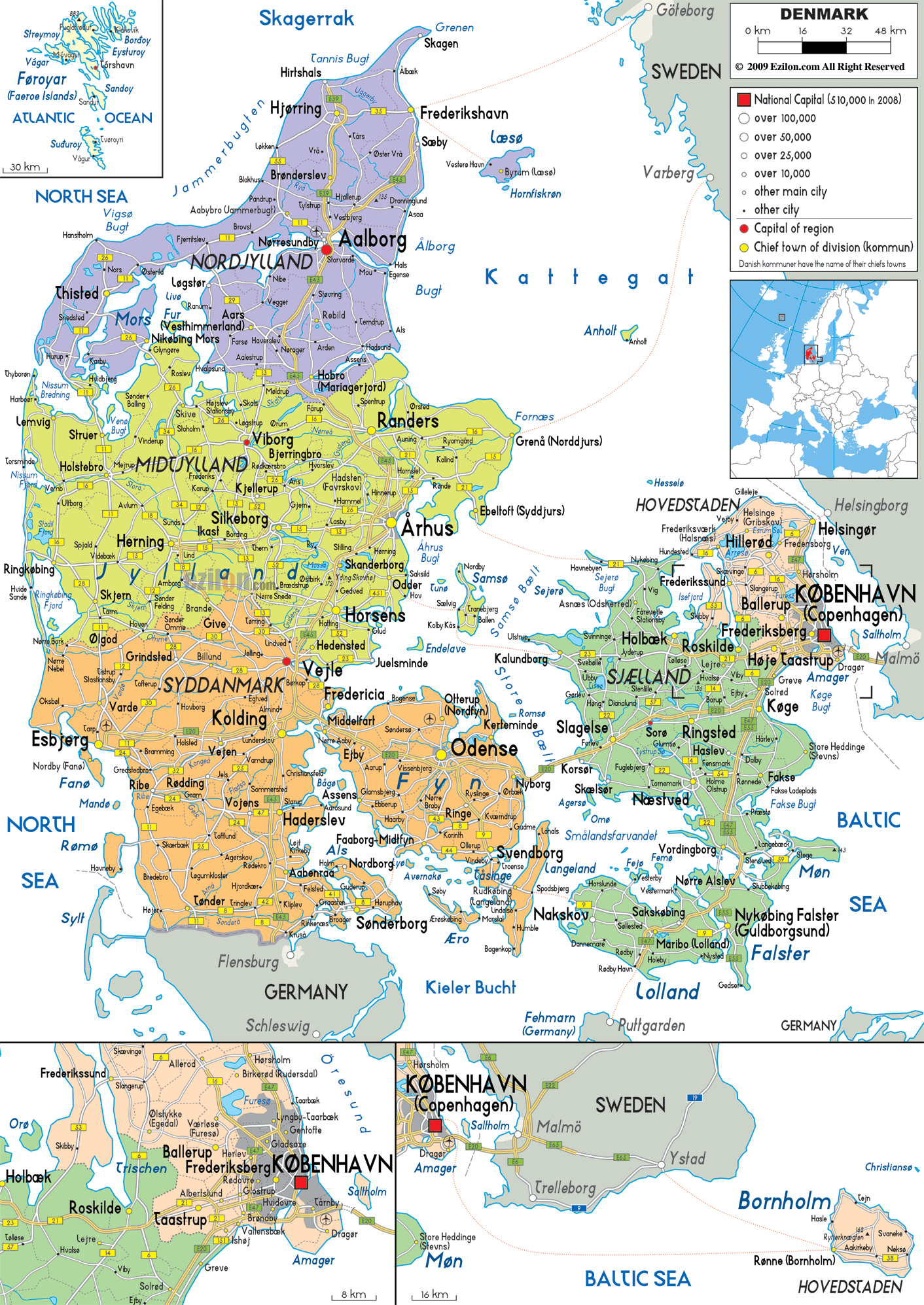

Description: Detailed large political map of Denmark with road routes from cities to towns, road intersections to provinces and perfectures.
 Situated
in Northwestern Europe Denmark is the smallest of the
Scandinavian countries with over 400 islands linked to
the mainland by bridges or ferries and its borders
touching Germany. The official language is Danish,
although German and English are widespread.
Denmark’s landscape is low and fertile, strewn with
beech woods, fjords and lakes on which picturesque
villages, towns, historic castles and monuments are
scattered. These rolling hills offer magnificent views
over forests and lake districts, while the coastline
boasts spectacular sand dunes and white cliffs, not to
mention the quaint Danish islands. The beaches on the
coast and the islands are a beautifully kept offering
pristine sands and well kept sites; here most people
prefer cycling in order to preserve the land and keep
the country’s beauty intact.

Physical Map of Denmark
Physical map and map image of Denmark.

Road Map of Denmark
Road map and map image of Denmark.

Regional Directory of United States of America
Information and guide about United States of America and websites with American topics.

Regional Directory of Europe
Information and guide about Europe and websites with European topics.

Regional Directory of Australia
Information and guide about Australia and websites with Australian topics.