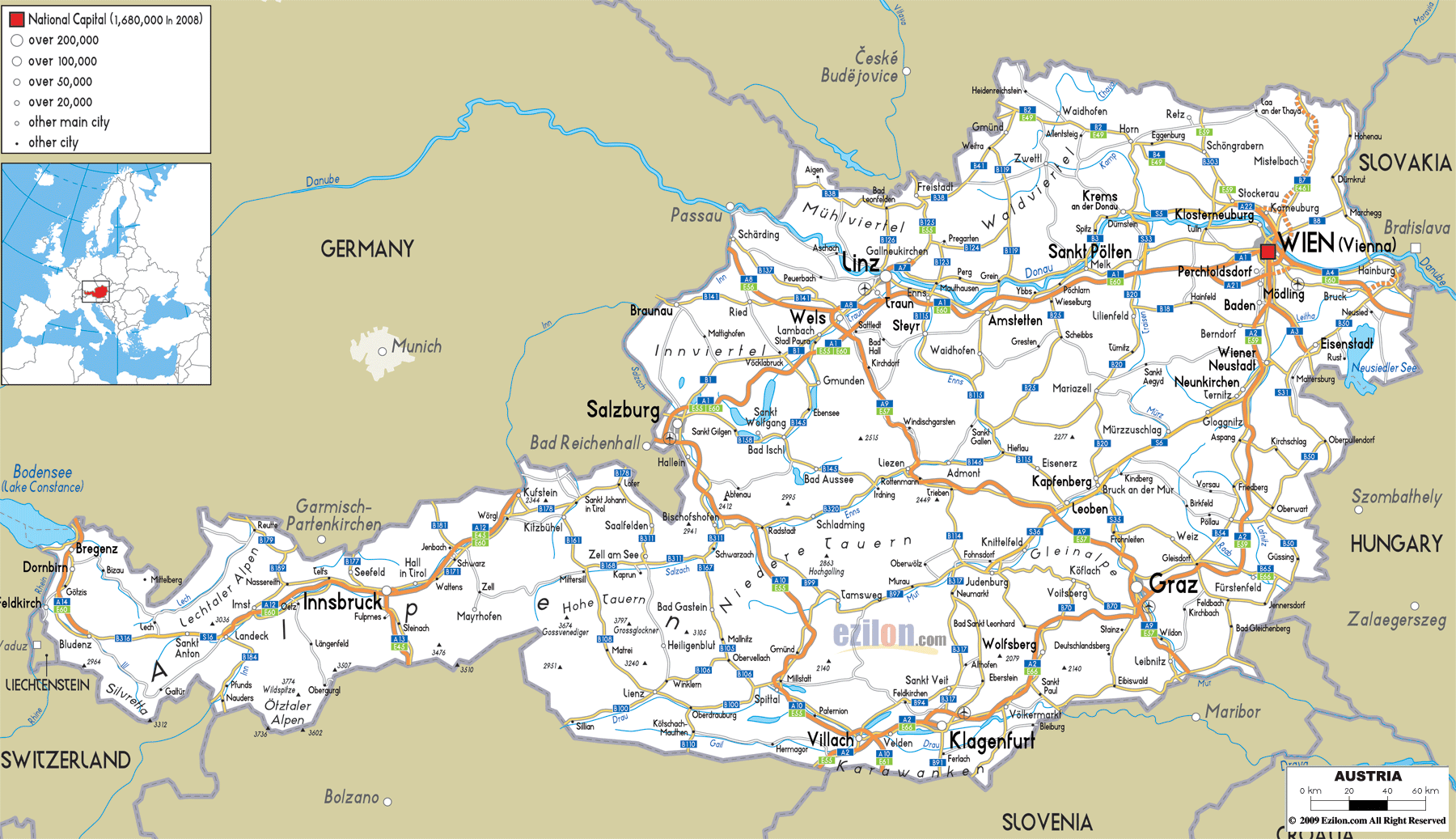

Description: Detailed clear large road map of Austria with road routes from cities to towns, road intersections to regions, provinces, prefectures also with routes leading to neighboring countries.
 Austria has well-developed road network with road network covering almost all towns, cities and villages just as in other developed European countries in the EU.
These roads can be seen in the travel road map above and with narration as follows: Major road connects Linz in the North and pass through towns such as Traun, Enns, all the way to the Eastern city of Vienna. Major road connects Salzburg in the North with Villach in the southern part, passing through Klagenfurt, to Graz extending to Wien.
European roads from other EU countries also pass through or end in Austria, for instance E651 connecting Altenmarkt im Pongau town to Liezen, E 52 that ends in Salzburg, E652 road and other roads .
Austrian road are made of Motorways and Expressways as follows: A1 (Westautobahn), A2 (Südautobahn), A3 (Südostautobahn), A4 (Ostautobahn), A5 (Nordautobahn, planned), A6 (Nordostautobahn), A7 (Mühlkreisautobahn), A8 (Innkreisautobahn), A9 (Pyhrnautobahn), A10 (Tauernautobahn), A11 (Karawankenautobahn), A12 (Inntalautobahn), A13 (Brennerautobahn), A14 (Rheintalautobahn), A21 (Wiener Außenringautobahn), A22 (Donauuferautobahn), A23 (Südosttangente), A24 (Verbindungsspange Rothneusiedel, planned), A25 (Welser Autobahn) and A26 (Linzerautobahn, planned).

Political Map of Austria
Political map and map image of Austria.

Physical Map of Austria
Physical map and map image of Austria.

Regional Directory of United States of America
Information and guide about United States of America and websites with American topics.

Regional Directory of Europe
Information and guide about Europe and websites with European topics.

Regional Directory of Australia
Information and guide about Australia and websites with Australian topics.