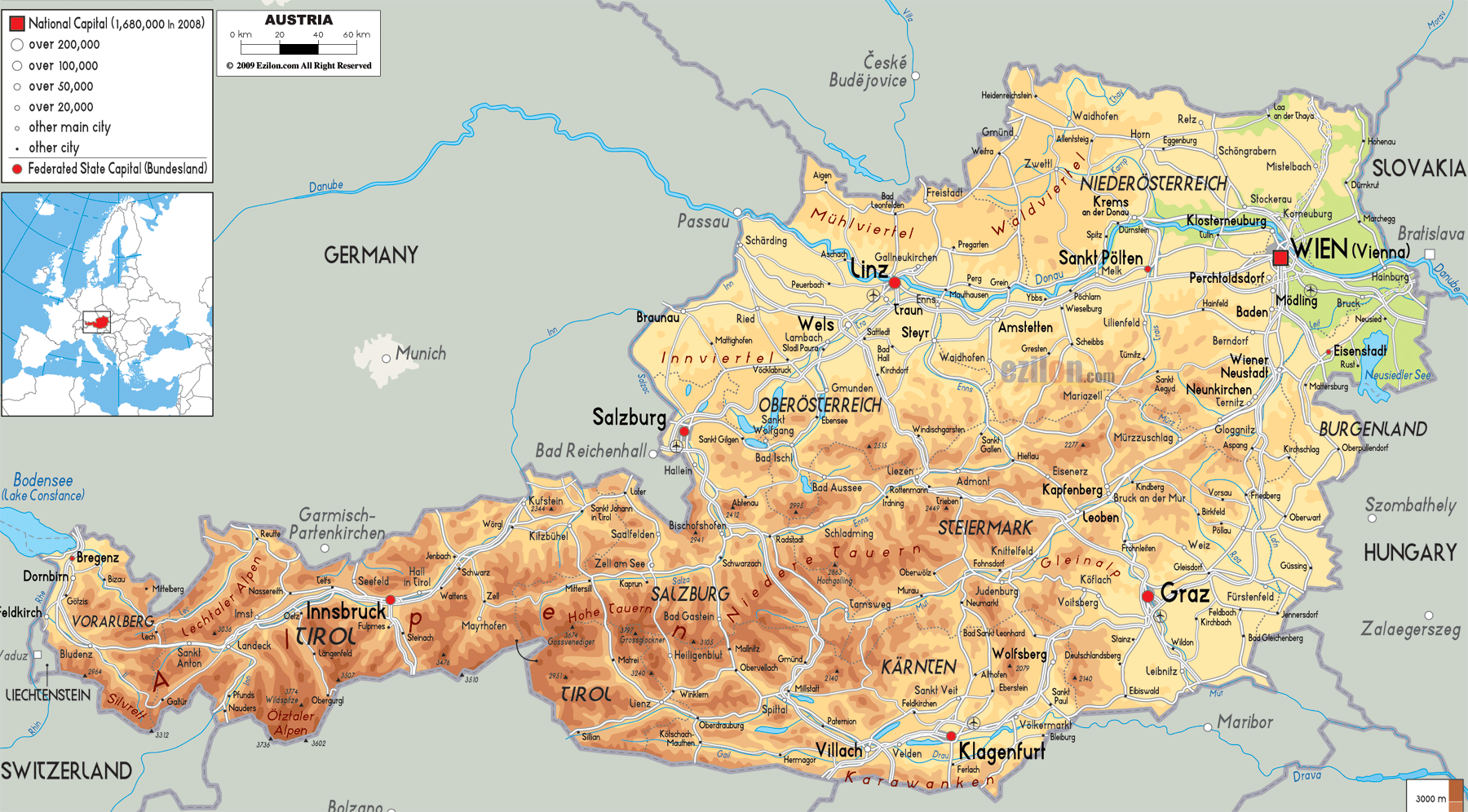

Description: The Physical Map of Austria showing major geographical features like elevations, mountain ranges, lakes, plateaus, peninsulas, rivers, plains, landforms and other topographic features.
 The
Republic of Austria is a country located in the centre
of the European Continent. The Czech Republic and
Germany border the country to the north whereas the
southern lines are shared with Slovenia and Italy.
The eastern borders are shared with Hungary and Slovakia
meanwhile the western borders are common with
Switzerland and Liechtenstein. The total land area
covered sums up to be 83855 square kilometres. Lying
within the Alps mountain range, the country is quite
elevated and only 32% of the country is located at a
height below 500 metres.
More than 60% of the total land area is covered by the
Eastern Alps. Danube is the longest river in the country
which empties itself into the Black Sea and is closely
followed by the Drava River. The Neusiedler Lake is a
large and popular lake in the eastern side of the
country near Slovakia and Hungary.

Political Map of Austria
Physical map and map image of Austria.

Road Map of Austria
Road map and map image of Austria.

Regional Directory of United States of America
Information and guide about United States of America and websites with American topics.

Regional Directory of Europe
Information and guide about Europe and websites with European topics.

Regional Directory of Australia
Information and guide about Australia and websites with Australian topics.