
Description: The Physical Map of Armenia showing major geographical features like elevations, mountain ranges, lakes, plateaus, peninsulas, rivers, plains, landforms and other topographic features.
 Armenia
or the Republic of Armenia is a country located in the
South Caucasus area of Eurasia. It is a mountainous
country present in the area where Eastern Europe meets
Western Asia.
The country shares its western borders with Turkey and
northern lines with Georgia. Azerbaijan is located to
the east and the south is bordered by Iran. The country
is a locked land and is right between the Black and
Caspian Seas.
Armenia is also called the land of rivers and lakes for
the many water bodies present there. The longest river
is called Akhurian River and is 205 kilometres long. The
largest lake in the country is Lake Sevan. The country
also has over 100 mountain lakes which are yet to be
studied.

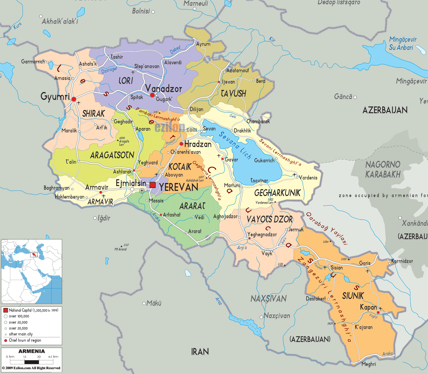
Politica Map of Armenia
Political map and map image of Armenia.

Road Map of Armenia
Road map and map image of Armenia.

Regional Directory of United States of America
Information and guide about United States of America and websites with American topics.

Regional Directory of Europe
Information and guide about Europe and websites with European topics.

Regional Directory of Australia
Information and guide about Australia and websites with Australian topics.