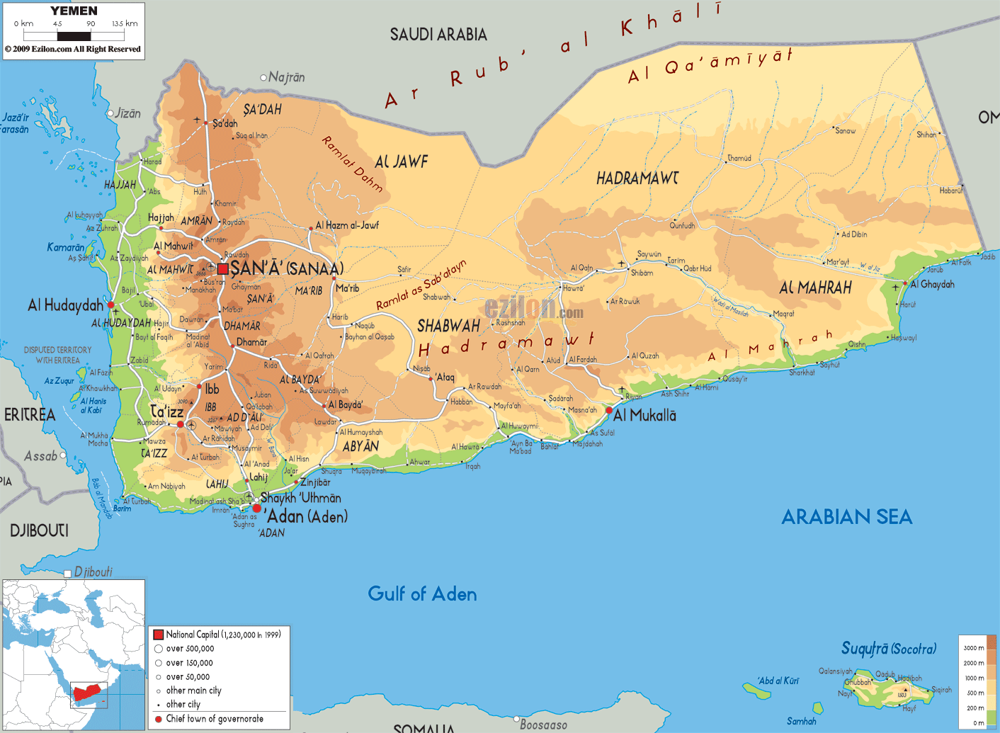

Description: The Physical Map of Yemen showing major geographical features like elevations, mountain ranges, deserts, seas, lakes, plateaus, peninsulas, rivers, plains, landforms and other topographic features.
 Yemen
is a country situated at the southernmost zone of the
Arabian Peninsula. The Bab-el-Mandeb Strait lines the
entrance to the country and also connects the Red Sea to
the Indian Ocean. The total area covered by the country
is 527970 square kilometres.
The west, east and south of the country is dominated by
thin coastal plains. The northern area of the country
has a high desert which lines its international
boundary.
The desert is called the Tihamah and is 419 kilometres in length. The country’s mountain ranges rise gradually and finally at Jabal al Shuayb the highest point is reached at 3666 metres above sea level. The ranges are separated into western and central highlands. The former consist of arable land with peaks touching the 3000 metre mark whereas the latter is more like a plateau region with rolling hills. The north-eastern region of the country is called the empty quarter as it is fully a desert.
The country has no permanent rivers; they only come
alive during the monsoon or wet season. The Wadi
Hadhramaut is the most important among all of them. The
river waters the eastern parts of the country. The
country also has long coastlines which add up to a
massive 1906 kilometres. The coasts are shared with the
Gulf of Aden, Arabian Sea and Red Sea.

Political Map of Yemen
Political map and map image of Yemen.

Road Map of Yemen
Road map and map image of Yemen.

Regional Directory of United States of America
Information and guide about United States of America and websites with American topics.

Regional Directory of Europe
Information and guide about Europe and websites with European topics.

Regional Directory of Australia
Information and guide about Australia and websites with Australian topics.