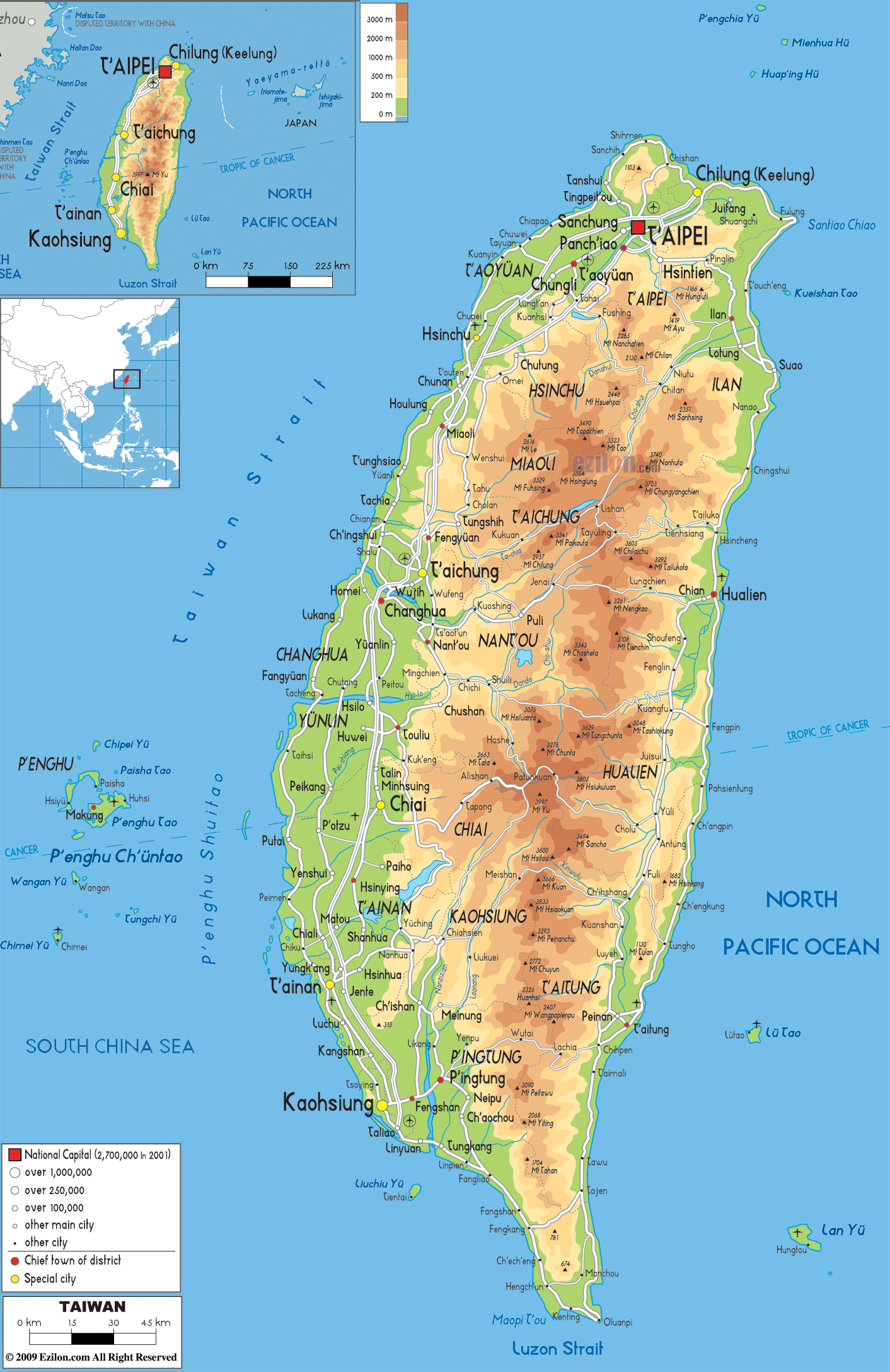

Description: The Physical Map of Taiwan showing major geographical features like elevations, mountain ranges, ocean, lakes, plateaus, peninsulas, rivers, plains, landforms and other topographic features.
 Taiwan
officially known as the Republic of China is a country
in Eastern Asia. Kinmen, Penghu, and Matsu, are other
islands of the country while the ninety nine percent of
the country is composed of the island of Taiwan.
Bordering countries are Japan to the east and northeast,
the People's Republic of China to the west and the
Philippines in the south. 36,193 square kilometres is
the total area of the Taiwan.
The shape of the Taiwan is similar to that of the Sweet
Potato when seen from south to north direction.
Taiwan has rugged mountain ranges which run from north
to south in five ranges. Yu Shan (Jade Mountain) at
3,952 metres is the highest point of the country. It has
five peaks over 3,500 metres and this makes Taiwan the
4thhighest Island in the world.
Taiwan is situated on the complex tectonic plate system
which consists of the Philippine Mobile Belt on the east
and south, the Yangtze Plate to the west and north and
the Okinawa Plate on the north-east.

Political Map of Taiwan
Political map and map image of Taiwan.

Road Map of Taiwan
Road map and map image of Taiwan.

Regional Directory of United States of America
Information and guide about United States of America and websites with American topics.

Regional Directory of Europe
Information and guide about Europe and websites with European topics.

Regional Directory of Australia
Information and guide about Australia and websites with Australian topics.