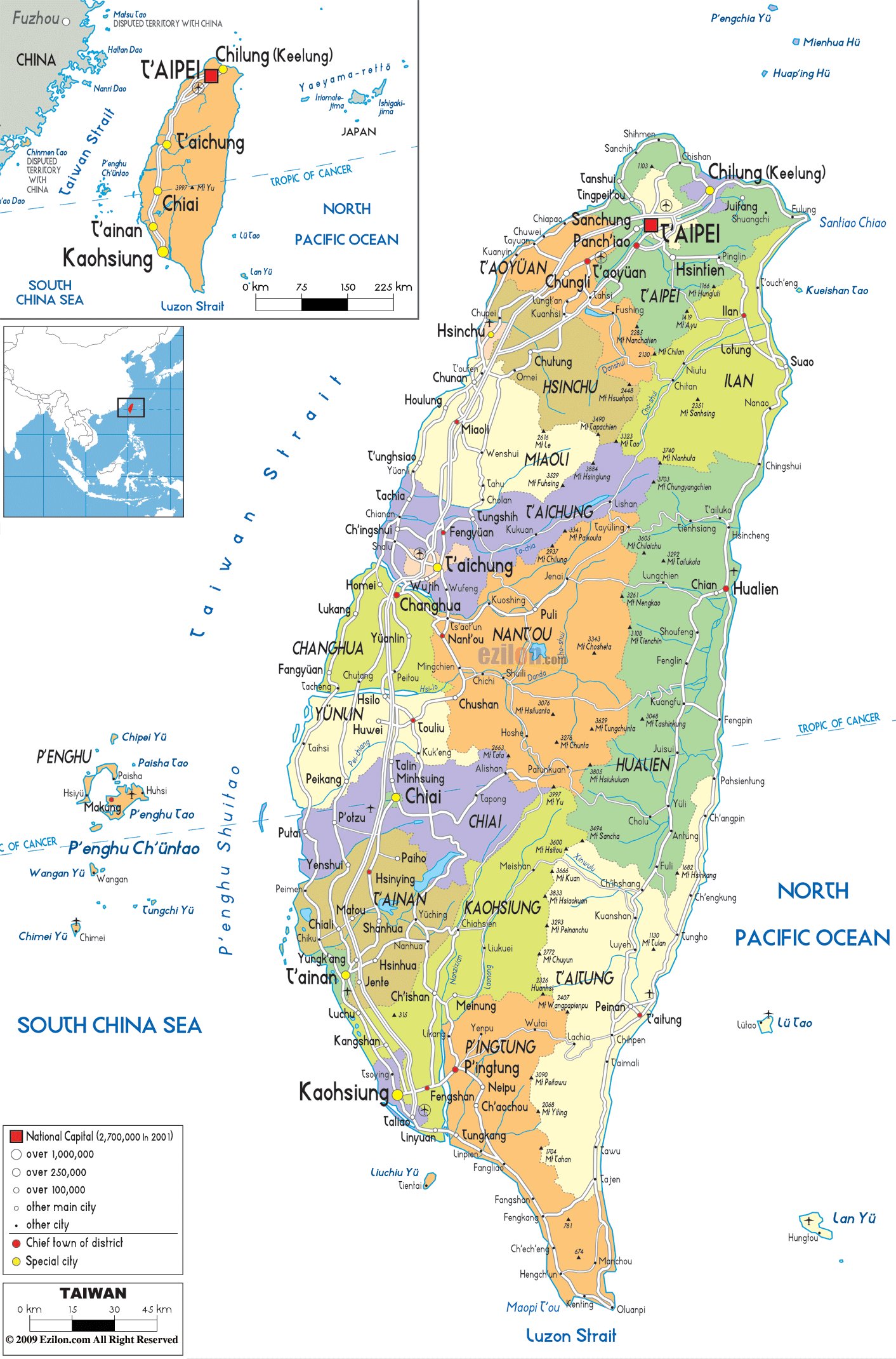
Description: Detailed large political map of Taiwan showing names of capital city, towns, states, provinces and boundaries with neighbouring countries.
 Taiwan
is a nation that is situated in the east of Asia and it
is sandwiched between he East China Sea and the South
China Sea. After the end of the Second World War, Taiwan
has been under the rule of China. The country has a
marine tropical climate where the summer months start
from June till September. Taiwan is a country where
typhoons and earthquakes are not considered to be
uncommon. The capital city is Taipei and this is the
most developed city in the country. There are about 22.9
million people living in this island nation.
Taiwan
is a nation that is situated in the east of Asia and it
is sandwiched between he East China Sea and the South
China Sea. After the end of the Second World War, Taiwan
has been under the rule of China. The country has a
marine tropical climate where the summer months start
from June till September. Taiwan is a country where
typhoons and earthquakes are not considered to be
uncommon. The capital city is Taipei and this is the
most developed city in the country. There are about 22.9
million people living in this island nation.

Physical Map of Taiwan
Physical map and map image of Taiwan.

Road Map of Taiwan
Road map and map image of Taiwan.

Regional Directory of United States of America
Information and guide about United States of America and websites with American topics.

Regional Directory of Europe
Information and guide about Europe and websites with European topics.

Regional Directory of Australia
Information and guide about Australia and websites with Australian topics.