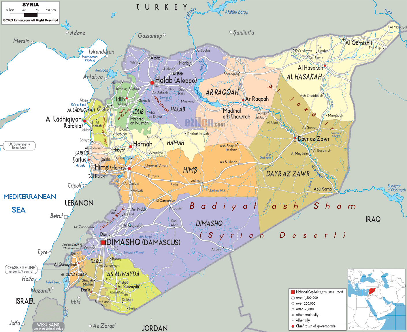
Description: Detailed large political map of Syria showing names of capital city, towns, states, provinces and boundaries with neighbouring countries.
 Syria
is situated in western Asia and it is officially known
as the Syrian Arab Republic. The Mediterranean Sea and
Lebanon is located on the west of the country and Iraq
is situated on the east of the country. It has Jordan on
its south and Turkey on its north.
Damascus is the capital city of Syria and this city is considered to be
one among the world’s oldest constantly inhabited
cities. Most of the people living in this country are
Sunni Muslims but there are also followers of other
religions as well. More than 4/5th of the people living
in Syria are Arabs and the remaining people are of
Turkmen, Kurdish, Aramaean Syriacs, Assyrian,
Circassians and Armenian minorities.
Syria
is situated in western Asia and it is officially known
as the Syrian Arab Republic. The Mediterranean Sea and
Lebanon is located on the west of the country and Iraq
is situated on the east of the country. It has Jordan on
its south and Turkey on its north.
Damascus is the capital city of Syria and this city is considered to be
one among the world’s oldest constantly inhabited
cities. Most of the people living in this country are
Sunni Muslims but there are also followers of other
religions as well. More than 4/5th of the people living
in Syria are Arabs and the remaining people are of
Turkmen, Kurdish, Aramaean Syriacs, Assyrian,
Circassians and Armenian minorities.

Physical Map of Syria
Physical map and map image of Syria.

Road Map of Syria
Road map and map image of Syria.

Regional Directory of United States of America
Information and guide about United States of America and websites with American topics.

Regional Directory of Europe
Information and guide about Europe and websites with European topics.

Regional Directory of Australia
Information and guide about Australia and websites with Australian topics.