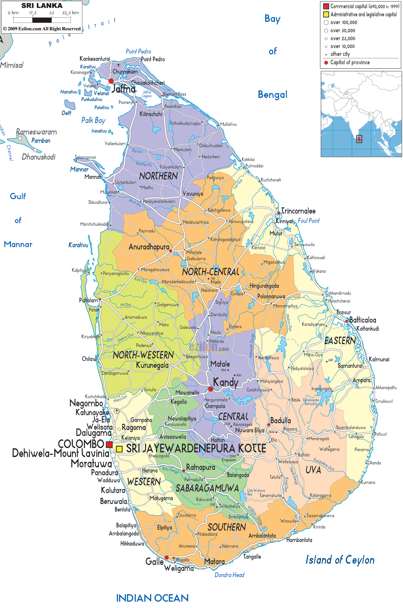

Description: Detailed large political map of Sri Lanka showing names of capital city, towns, states, provinces and boundaries with neighbouring countries.
 Sri
Lanka is also referred to as the Democratic Socialist
Republic of Sri Lanka. It is basically an island nation
that is located in the South of Asia and it lies about
thirty-one kilometers from the southern coats of India.
The population of Sri Lanka is about twenty million
people. This country is popular for producing and
exporting rubber, coconuts, coffee and tea. Sri Lanka is
also considered to be one of the popular tourist
destinations in the world because it has lovely
landscapes and beaches, tropical forests and a rich
culture. There are two official languages in this
country and they are Tamil and Sinhalese.

Physical Map of Sri Lanka
Physical map and map image of Sri Lanka.

Road Map of Sri Lanka
Road map and map image of Sri Lanka.

Regional Directory of United States of America
Information and guide about United States of America and websites with American topics.

Regional Directory of Europe
Information and guide about Europe and websites with European topics.

Regional Directory of Australia
Information and guide about Australia and websites with Australian topics.