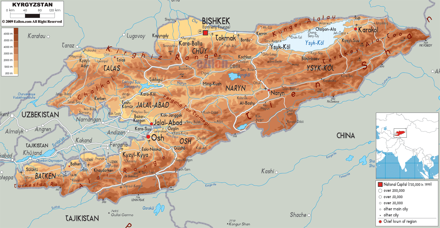

Description: The Physical Map of Kyrgyzstan showing major geographical features like elevations, mountain ranges, deserts, seas, lakes, plateaus, peninsulas, rivers, plains, landforms and other topographic features.
 Formerly
known as Kirghizia, Kyrgyzstan officially called the
Kyrgyz Republic is situated in Central Asia. It is a
landlocked country with Tajikistan to the southwest,
Kazakhstan to the north, China to the east and
Uzbekistan to the west.
Eighty percent of the country is covered by mountains
which is called Tian Shan. The country has no coastline
to any sea and so all the rivers flow into the closed
drainage system which has no reach to the sea. The
remaining twenty percent of the country is made up of
basins and valleys.
The cultivable land is found in the Valley of
Fergana. Rare earth metals and Gold can be found in
abundance in the country. Kara Darya is the main
river which runs from west and falls into Uzbekistan
running through the Valley of Fergana. Naryn is another
river which flows into Uzbekistan and the confluence of
these rivers forms Syr Darya.

Political Map of Kyrgyzstan
Political map and map image of Kyrgyzstan.

Road Map of Kyrgyzstan
Road map and map image of Kyrgyzstan.

Regional Directory of United States of America
Information and guide about United States of America and websites with American topics.

Regional Directory of Europe
Information and guide about Europe and websites with European topics.

Regional Directory of Australia
Information and guide about Australia and websites with Australian topics.