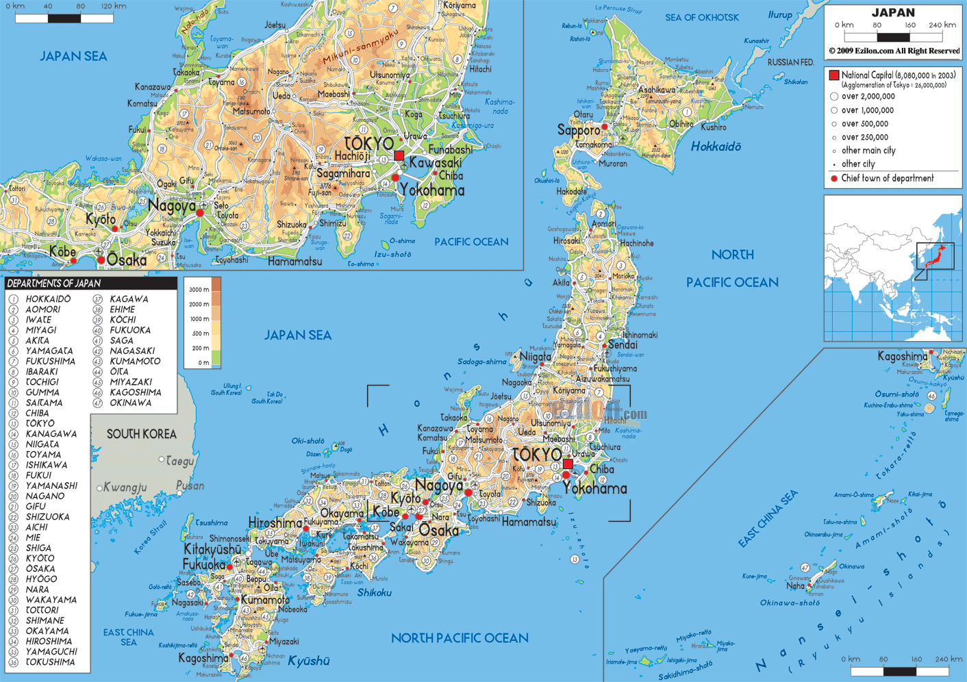

Description: The Physical Map of Japan showing major geographical features like elevations, mountain ranges, deserts, ocean, lakes, plateaus, peninsulas, rivers, plains, landforms and other topographic features.
 Japan
which is an island is a country in East Asia. It is
situated in the Pacific Ocean. To the west of Japan lie
South Korea and Russia, China, the Sea of Japan and
North Korea.
It is an archipelago of islands numbering 6,852. Honshu, Shikoku, Hokkaido and Kyushu are the four main islands which constitutes about ninety-seven percent of Japan's land area.
It stretches along the Pacific coast of East Asia. To the south of Kyushu is a chain of Ryukyu Islands which consists of Okinawa. All the islands are together known as Japanese Archipelago.
Japan is located on the Pacific Ring of Fire which is
in a volcanic zone where several continental plates meet
and it experiences frequent earthquakes.
Most of the Japan's mountains are active volcanoes.
It was initially attached to the eastern coast of the
Eurasian continent but due to the subducting plates it
pulled away eastward and formed the Sea of Japan around
fifteen million years ago. Mount Fuji is the highest
volcano in Japan and is an active volcano.

Political Map of Japan
Political map and map image of Japan.

Road Map of Japan
Road map and map image of Japan.

Regional Directory of United States of America
Information and guide about United States of America and websites with American topics.

Regional Directory of Europe
Information and guide about Europe and websites with European topics.

Regional Directory of Australia
Information and guide about Australia and websites with Australian topics.