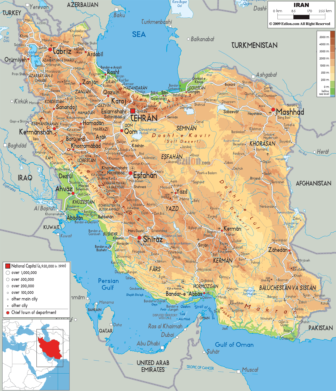

Description: The Physical Map of Iran showing major geographical features like elevations, mountain ranges, deserts, seas, lakes, plateaus, peninsulas, rivers, plains, landforms and other topographic features.
 Iran
or Persia officially called the Islamic Republic of
Iran. It is situated in West Asia with the total area of
1,648,195 square kilometres.
Iran
or Persia officially called the Islamic Republic of
Iran. It is situated in West Asia with the total area of
1,648,195 square kilometres.
It is bordered to the northeast by Turkmenistan; to the
northwest by Armenia and Azerbaijan to the south by the
Persian Gulf and the Gulf of Oman; the east by
Afghanistan and Pakistan, and to the west by Turkey and
Iraq. It shares coastline with Caspian Sea, Gulf of Oman
and Indian Ocean. Iran is centrally located in Western
Asia, Eurasia and the Strait of Hormuz and so it has
very geostrategic importance.
Its landscape is dominated by mountains and is one of
the world’s mountainous countries. They separate
different land features from one another like plateaus
and basins. The Caucasus, Zagros and Alborz Mountains
are the mountain ranges in the western part of the Iran.
Mount Damavand at 5,610 meters is the highest point.
Dense rain forests called Shomal or the Jungles of Iran
covers the northern part of Iran. The Dasht-e Kavir
desert is located in the eastern part of the country.
Dasht e lut is the largest desert and is located in
north of the country. The coast of the Caspian Sea has
the only large plains.

Political Map of Iran
Political map and map image of Iran.

Road Map of Iran
Road map and map image of Iran.

Regional Directory of United States of America
Information and guide about United States of America and websites with American topics.

Regional Directory of Europe
Information and guide about Europe and websites with European topics.

Regional Directory of Australia
Information and guide about Australia and websites with Australian topics.