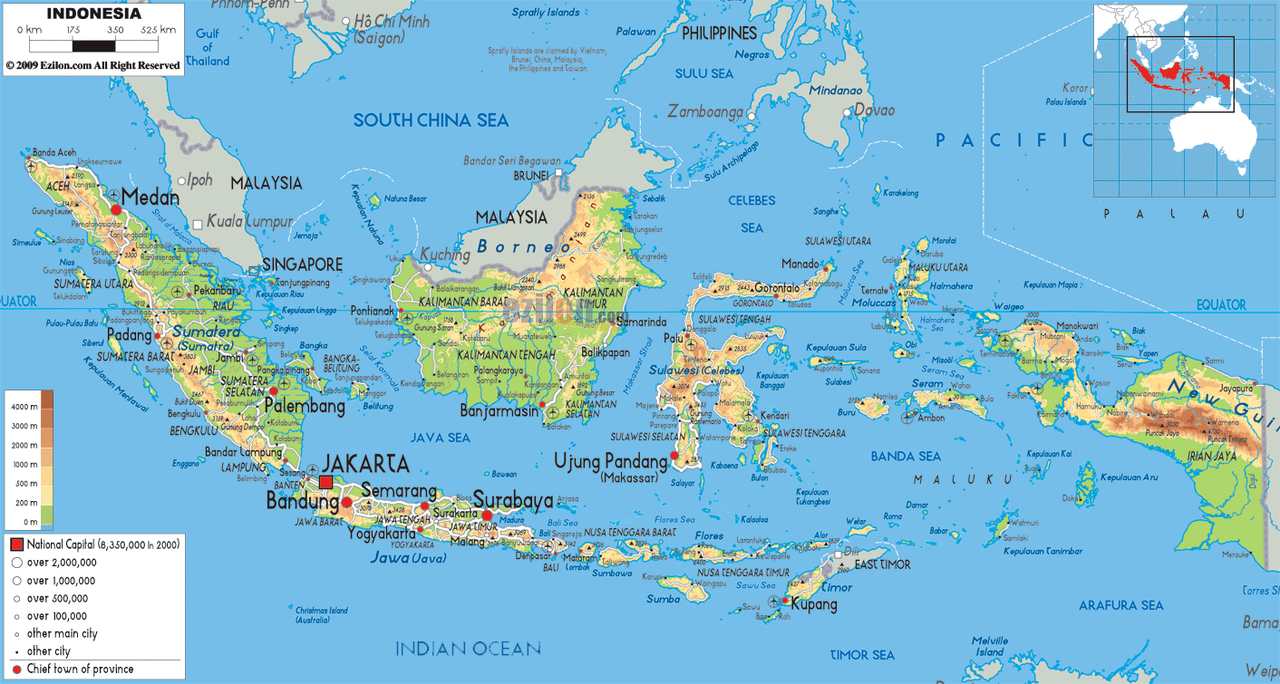

Description: The Physical Map of Indonesia showing major geographical features like elevations, mountain ranges, deserts, seas, lakes, plateaus, peninsulas, rivers, plains, landforms and other topographic features.
 Indonesia
situated in Southeast Asia and Oceania and has official
name, the Republic of Indonesia. Papua New Guinea, East
Timor, and Malaysia shares land borders with Indonesia.
It is placed at number 15 in terms of area. Singapore,
the Indian territory of the Andaman and Nicobar Islands,
Australia, Philippines and Palau are the neighbouring
countries. Maritime borders of Indonesia are shared by
Malaysia, the Philippines, Singapore, Palau and
Australia.
The islands of Indonesia are located on the both sides
of Equator. There are 17,508 islands of Indonesia. 6,000
of these islands are not in use by humans. Borneo
(shared with Brunei and Malaysia), Java, Sumatra, New
Guinea (shared with Papua New Guinea), and Sulawesi are
the largest islands of Indonesia. 1,919,440 square
kilometres is the total area of Indonesia.
Indonesia's highest peak is Puncak Jaya at 4,884 metres.
The largest lake is Lake Toba in Sumatra with an area of
1,145 square kilometres. The Mahakam and Barito are the
largest and main rivers of Indonesia. Tambora and
Krakatoa are the active volcanoes among 150 others.
It is located on tectonic plates namely, Australian
tectonic plate, Eurasian and Pacific plate.
Indonesia has number of volcanoes and is a place for
frequent earthquakes.

Political Map of Indonesia
Political map and map image of Indonesia.

Road Map of Indonesia
Road map and map image of Indonesia.

Regional Directory of United States of America
Information and guide about United States of America and websites with American topics.

Regional Directory of Europe
Information and guide about Europe and websites with European topics.

Regional Directory of Australia
Information and guide about Australia and websites with Australian topics.