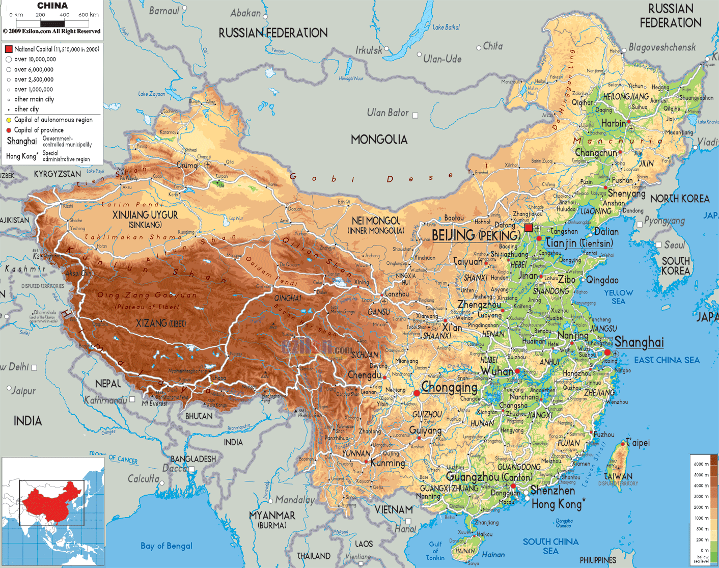

Description: The Physical Map of China showing major geographical features like elevations, mountain ranges, deserts, seas, lakes, plateaus, peninsulas, rivers, plains, landforms and other topographic features.
 Located
in East Asia is a country of China officially known as
the People's Republic of China. It is the second-largest
country in the world and the most populous one.
China's total area is 9,600,000 square kilometres. China
shares border with India, Bhutan, Nepal and Pakistan in
South Asia, Vietnam, Laos, and Burma in Southeast Asia,
Russia, Mongolia, and North Korea in Inner Asia and
Northeast Asia, Afghanistan, Tajikistan, Kyrgyzstan and
Kazakhstan in Central Asia.
Mount Everest at 8,848m, the world’s highest peak is
situated on the Sino-Nepalese border. The Ayding Lake at
−154m which is a dried lake bed is situated in the
Turpan Depression is the lowest point and world’s third
lowest.
In the north high plateaus are the main features of the
country. On the Mongolian Plateau, grasslands forms the
major landscapes.
Eastern part of the country is very fertile because of
the two major seas.The continued expansion of its
deserts, particularly the Gobi Desert is the issue of
concern for China.

Political Map of China
Political map and map image of China.

Road Map of China
Road map and map image of China.

Regional Directory of United States of America
Information and guide about United States of America and websites with American topics.

Regional Directory of Europe
Information and guide about Europe and websites with European topics.

Regional Directory of Australia
Information and guide about Australia and websites with Australian topics.