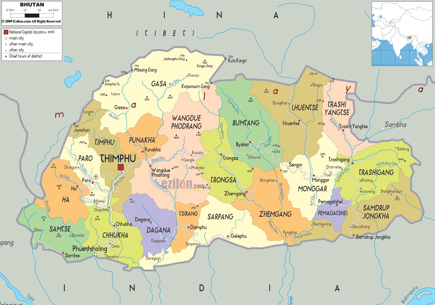

Description: Detailed large political map of Bhutan showing names of capital city, towns, states, provinces and boundaries with neighbouring countries.
 The
Kingdom of Bhutan lies nestled in the eastern Himalayas,
with China on the southeastern border and India on the
west. Bhutan's land varies considerably in altitude from
just above 100 mt in the lowlands to over 7000 meters in
the Himalayan plateau to the north.
The population is very sparse and mostly concentrated in
Thimphu, the capital. Bhutan is a kingdom state led by
both monarchs and priests and the official language is
Dzongkha, as well as numerous other dialects, although
English is widely spoken, being integrated in the
educational system.
The land is rich in striking contrasts depending on the
different regions offering three distinct climates. The
inner Himalaya is temperate, rich in forestland and
populated by boar, bear and sambar, while the Higher
Himalaya region features breathtaking mountain slopes
home to a variety of different species, including blue
sheep and snow leopard.

Physical Map of Bhutan
Physical map and map image of Bhutan.

Road Map of Bhutan
Road map and map image of Bhutan.

Regional Directory of United States of America
Information and guide about United States of America and websites with American topics.

Regional Directory of Europe
Information and guide about Europe and websites with European topics.

Regional Directory of Australia
Information and guide about Australia and websites with Australian topics.