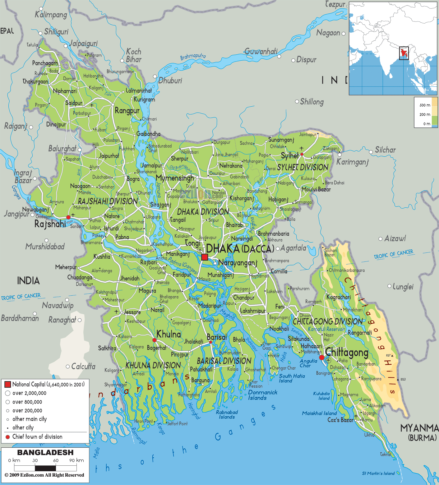

Description: The Physical Map of Bangladesh showing major geographical features like elevations, mountain ranges, ocean, lakes, plateaus, peninsulas, rivers, plains, landforms and other topographic features.
 It
is country in South Asia with an official name as the
People's Republic of Bangladesh. It is surrounded by
India from the western, eastern andnorthern sides. It
also has Burma on its south-east boundary. There is Bay
of Bengal on its southern end. The Chicken’s neck
separates it from Bhutan and Nepal.
The mountain ranges include the Garo, the Khasi and the
Tripura Hills and the Bhawal highlands. The highland
formations also include the Chittagong Hill Tracts as
well as the Arakan. The Saka Haphong present in the
Mowdok range of Chittagong Hill Tracts is the highest
peak in Bangladesh.
The Sundarbans is full of marshes and is proclaimed as
the largest mangrove forest in the world. This form most
of the coastline of the Bangladesh with diverse flora
and fauna and home to the Royal Bengal Tiger. Its
topographic location makes it prone to destructive
cyclones, earthquakes and floods.

Political Map of Bangladesh
Political map and map image of Bangladesh.

Road Map of Bangladesh
Road map and map image of Bangladesh.

Regional Directory of United States of America
Information and guide about United States of America and websites with American topics.

Regional Directory of Europe
Information and guide about Europe and websites with European topics.

Regional Directory of Australia
Information and guide about Australia and websites with Australian topics.