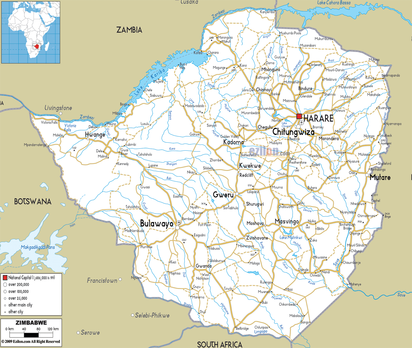
Description: Detailed clear large road map of Zimbabwe with road routes from cities to towns, road intersections to provinces and perfectures.
 The
Republic of Zimbabwe was previously known as Zimbabwe
Rhodesia, Republic of Rhodesia and Southern Rhodesia.
This nation is situated on the south of Africa and
Zimbabwe is basically a landlocked nation. It lies
between two rivers and they are the Limpopo River and
the Zambezi River. The country is bordered by Mozambique
on its east, Zambia on its northwest, Botswana on is
southwest and South Africa on its south. There are three
official languages in the country and they are English,
Ndebele and Shona. There are about twelve million people
living in Zimbabwe and the country has the lowest life
expectancy in the world.
The
Republic of Zimbabwe was previously known as Zimbabwe
Rhodesia, Republic of Rhodesia and Southern Rhodesia.
This nation is situated on the south of Africa and
Zimbabwe is basically a landlocked nation. It lies
between two rivers and they are the Limpopo River and
the Zambezi River. The country is bordered by Mozambique
on its east, Zambia on its northwest, Botswana on is
southwest and South Africa on its south. There are three
official languages in the country and they are English,
Ndebele and Shona. There are about twelve million people
living in Zimbabwe and the country has the lowest life
expectancy in the world.
The people from Zimbabwe are called Zimbabweans.

Physical Map of Zimbabwe
Physical map and map image of Zimbabwe.

Political Map of Zimbabwe
Political map and map image of Zimbabwe.

Regional Directory of United States of America
Information and guide about United States of America and websites with American topics.

Regional Directory of Europe
Information and guide about Europe and websites with European topics.

Regional Directory of Australia
Information and guide about Australia and websites with Australian topics.