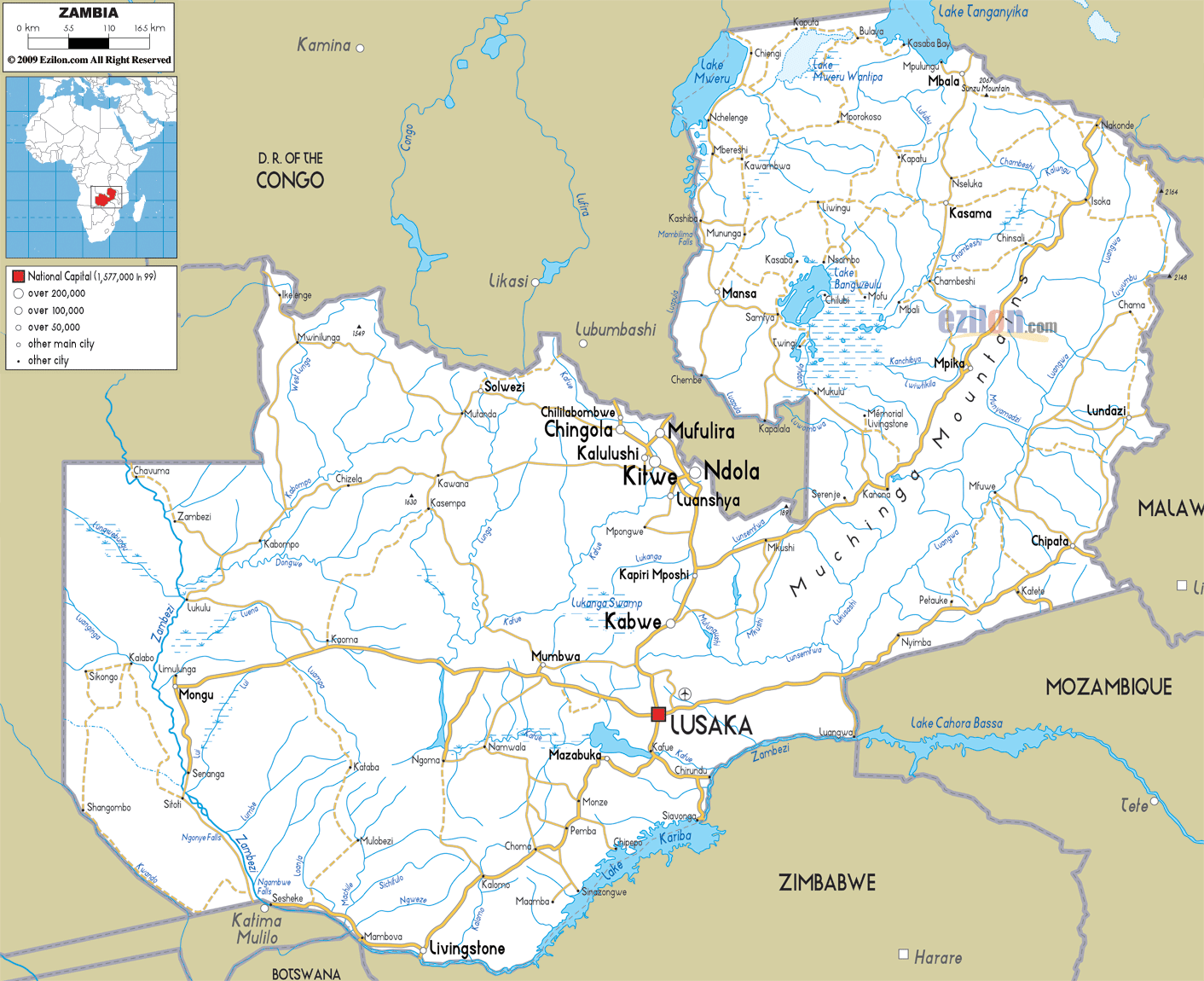
Description: Detailed clear large road map of Zambia with road routes from cities to towns, road intersections to provinces and perfectures.
 Zambia
is a nation that is located in the Southern Africa and
it is also referred to as the Republic of Zambia. It has
Angola on its west; Namibia, Zimbabwe, Mozambique and
Botswana on its south; Tanzania on its northeast; and
Congo on its north. Lusaka is the capital city of Zambia
and it is located on the southeast side of the nation.
Most of the people living in the country are residing in
Lusaka and the Copperbelt. Zambia is a nation that
experiences a tropical climate and it has many mountains
and hills. This landlocked nation is considered to be
the world's 39th largest country with an area of 752,614
square kilometers.
Zambia
is a nation that is located in the Southern Africa and
it is also referred to as the Republic of Zambia. It has
Angola on its west; Namibia, Zimbabwe, Mozambique and
Botswana on its south; Tanzania on its northeast; and
Congo on its north. Lusaka is the capital city of Zambia
and it is located on the southeast side of the nation.
Most of the people living in the country are residing in
Lusaka and the Copperbelt. Zambia is a nation that
experiences a tropical climate and it has many mountains
and hills. This landlocked nation is considered to be
the world's 39th largest country with an area of 752,614
square kilometers.
The people from Zambia are called Zambians.

Physical Map of Zambia
Physical map and map image of Zambia.

Political Map of Zambia
Political map and map image of Zambia.

Regional Directory of United States of America
Information and guide about United States of America and websites with American topics.

Regional Directory of Europe
Information and guide about Europe and websites with European topics.

Regional Directory of Australia
Information and guide about Australia and websites with Australian topics.