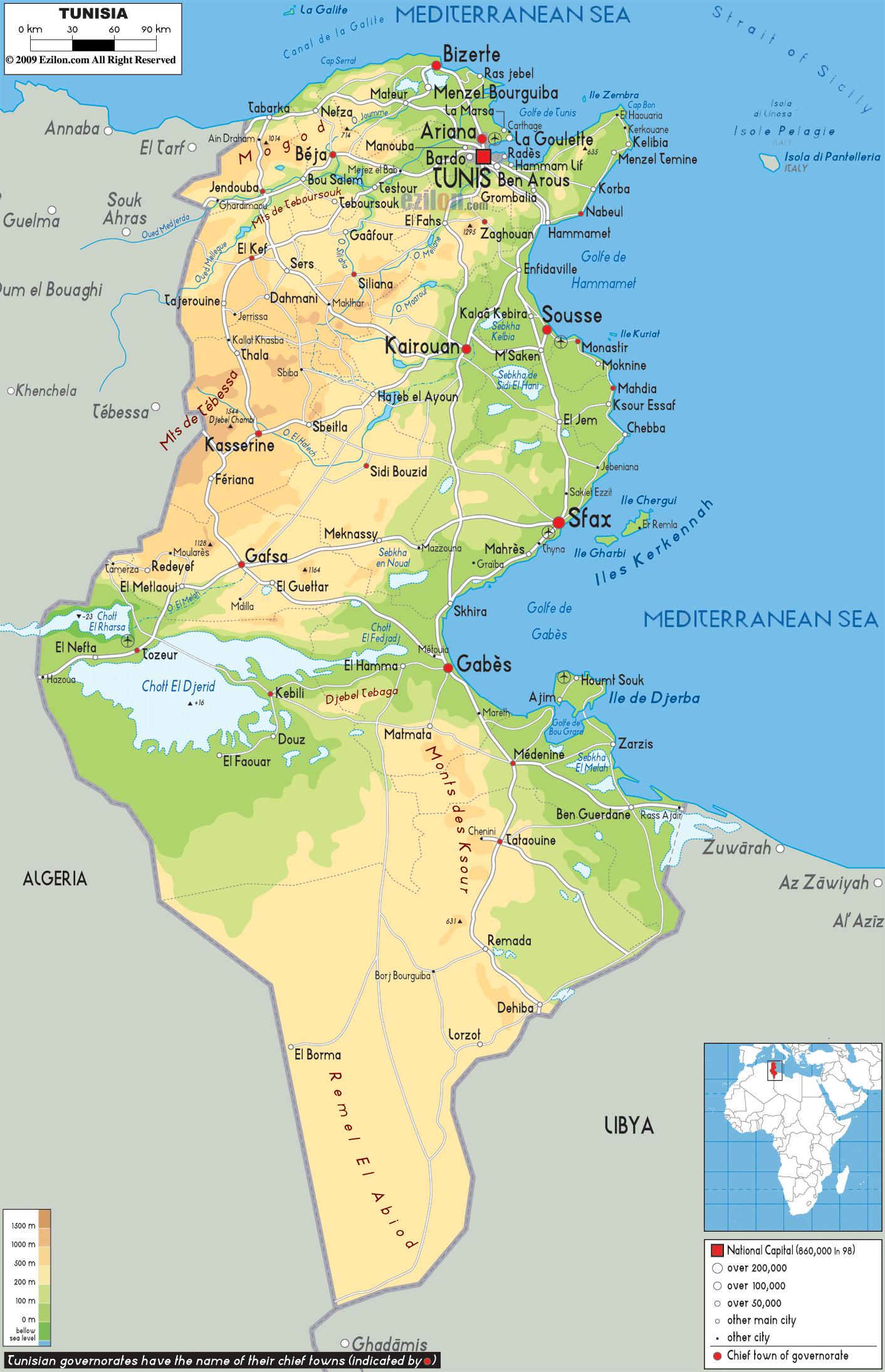

Description: The Physical Map of Tunisia showing major geographical features like elevations, mountain ranges, Seas, deserts, lakes, plateaus, peninsulas, rivers, plains, landforms and other topographic features.
 Tunisia
is officially known as the Tunisian Republic. It is the
northernmost country of African continent and covers an
area of about 166,000 square kilometres to become the
smallest country in the Maghreb region of North Africa.
It shares its borders with Algeria in the west, with
Libya in the southeast and touches the Mediterranean Sea
in the north-east.
Tunisia consists of the eastern part of the Atlas
Mountains as well as the northern ends of the Sahara
Desert. It has a 1,300 kilometer coastline which
includes the conjunction of the eastern as well as the
western parts of the Mediterranean Basin.It has two
distinctive Mediterranean Coasts. Tunisia is a
relatively small nation in size, but it has diverse
environment.
The climate is varied across the regions with
differences like those in the rest of the Maghreb and
rainfall differs accordingly. The Dorsal which form the
east extension of the Atlas Mountains, runs in a
northeasterly direction from the western Algerian border
to the Eastern Cape Bon peninsula. Tell lies to the
north of the Dorsal. This region is characterized by low
hills as well as plains. The Sahel are broadening
coastal plains along the eastern Mediterranean coast and
is considered to be among the world's best places for
cultivation of olives.

Political Map of Tunisia
Political map and map image of Tunisia.

Road Map of Tunisia
Road map and map image of Tunisia.

Regional Directory of United States of America
Information and guide about United States of America and websites with American topics.

Regional Directory of Europe
Information and guide about Europe and websites with European topics.

Regional Directory of Australia
Information and guide about Australia and websites with Australian topics.