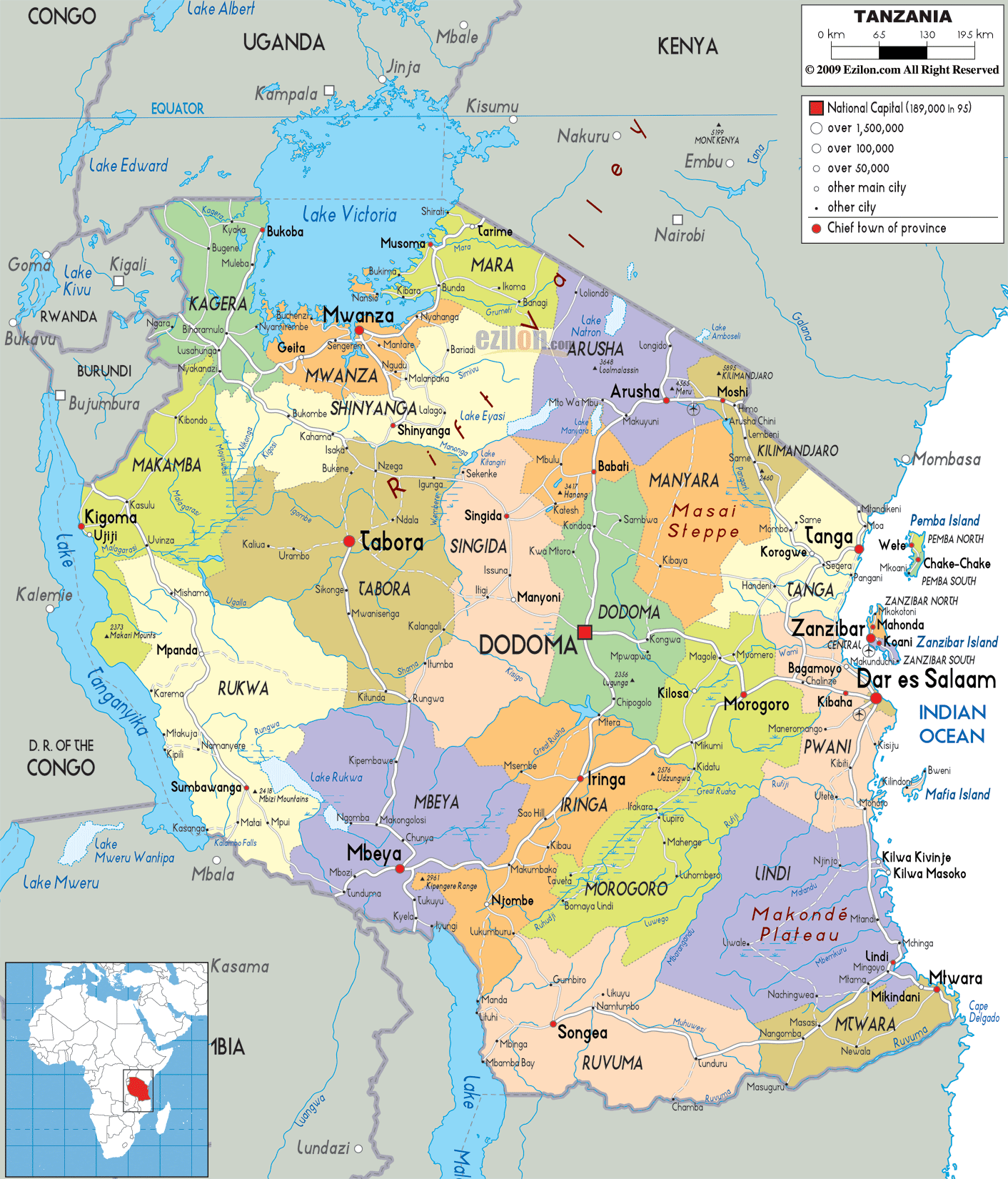

Description: Detailed large political map of Tanzania showing names of capital cities, towns, states, provinces and boundaries with neighbouring countries.
 Tanzania
is a sovereign nation in Africa and it is also referred
to as the United Republic of Tanzania. The east of this
nation is situated in the Indian Ocean and it has
Rwanda, Congo and Burundi on its west. Tanzania is the
31st largest country in the world with an area of about
945,087 square kilometers. The size of this country is
more or less like the size of Nigeria.
There are plenty of wildlife parks in Tanzania and these parks are not just large but they are economically important as well. The Kalambo water falls is being promoted by the Government of Tanzania and this water fall is considered to be one of the most popular tourist spots in the country. It is also the second highest fall in the African continent. The country experiences a climate that is similar to the tropical climate.
The people from Tanzania are called Tanzanians.

Physical Map of Tanzania
Physical map and map image of Tanzania.

Road Map of Tanzania
Road map and map image of Tanzania.

Regional Directory of United States of America
Information and guide about United States of America and websites with American topics.

Regional Directory of Europe
Information and guide about Europe and websites with European topics.

Regional Directory of Australia
Information and guide about Australia and websites with Australian topics.