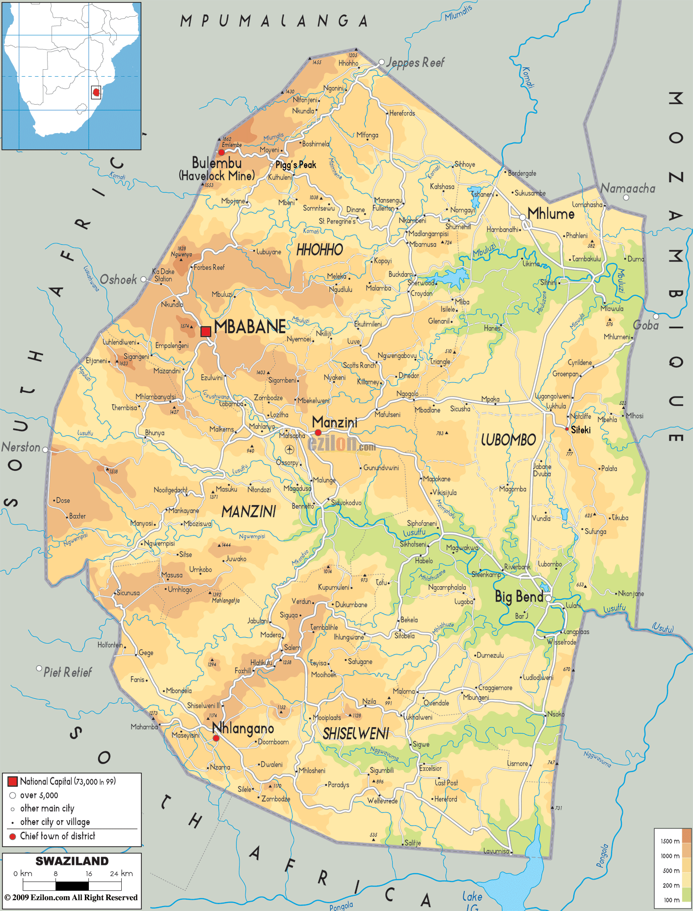

Description: The Physical Map of Swaziland showing major geographical features like elevations, mountain ranges, deserts, lakes, plateaus, peninsulas, rivers, plains, landforms and other topographic features.
 Swaziland
is officially known as the Kingdom of Swaziland. It is a
sovereign state located in South Africa. The ethnic
people of this country derive their names from Mswati
II, a king from the 19th-century king who ruled the
Swazi territory. Swaziland is a land-locked country
which is bordered in the North, South and West by South
Africa and has Mozambique to its East.
Even though Swaziland has a geographical area that
covers only 17,400 square kilometres of landmass, it
consists of four major geographical regions with varied
topography. These regions are differentiated from each
other on the basis of the climate prevalent and run from
the north to the country’s southern boundaries. There
are several rivers that flow through the country, the
Great Usutu River being the major river in the region.
Swaziland is divided into four climatic regions: the
Highveld, the Middleveld, the Lowveld as well as
theLubombo plateau. The seasons of the country are the
opposite of those prevalent in the Northern Hemisphere:
December being a mid-summer month and June being a
mid-winter month.

Political Map of Swaziland
Political map and map image of Swaziland.

Road Map of Swaziland
Road map and map image of Swaziland.

Regional Directory of United States of America
Information and guide about United States of America and websites with American topics.

Regional Directory of Europe
Information and guide about Europe and websites with European topics.

Regional Directory of Australia
Information and guide about Australia and websites with Australian topics.